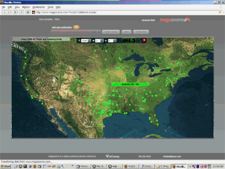
I built a simple quick and dirty map in Flex using geocoded data, a Map image
and a Plot chart from built-in charting.
Its not Google maps but gets the job done....and is totally self-contained.

http://www.magazooms.com/images/sampleMap.gif

I have worked with Yahoo maps, ESRI, and MapQuest and prefer MapQuest even
though it comes with significant fees.

Abyss Knight wrote:
>
>
> Check this out:
> http://www.adobe.com/devnet/flex/articles/dashboard_ilog.html
> <http://www.adobe.com/devnet/flex/articles/dashboard_ilog.html>
>
> -- William
>
> --- In flexcoders@yahoogroups.com <mailto:flexcoders%40yahoogroups.com>,
> kapil b <[EMAIL PROTECTED]> wrote:
>  >
>  > Hi All,
>  >
>  > Does anybody have idea how to implement gis(geographyical
> information system) in flex with the gis data in it.
>  >
>  > What kind of gis data format files the flex requires so that i can
> retrieve the data and display it in the UI.
>  >
>  >
>  > Thanks
>  >
>  >
>  > Bollywood, fun, friendship, sports and more. You name it, we
> have it on http://in.promos.yahoo.com/groups
> <http://in.promos.yahoo.com/groups>
>  >
>
>

--
Ben Marchbanks

::: magazooms :::
digital publishers,  taking print beyond paper......

http://www.magazooms.com

Greenville, SC
864.284.9918