Hilarious - very cool.

I'm not sure if these help, but they might be a start:
http://www.baseball-fever.com/showthread.php?97584-1923-Yankee-Stadium-3D-Renderings/page176&s=225b76fc00c536e907b34196a8a8074a
http://i1013.photobucket.com/albums/af252/bucket3nyy/1924aerial.jpg
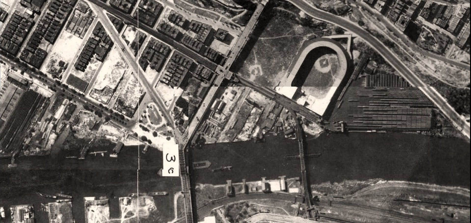
That may be taken from this one:
https://www.flickr.com/photos/67827566@N00/4312358659/

- Jeff

On Mon, Apr 27, 2015 at 1:07 PM, Richard Welty <[email protected]>
wrote:

> anyone have a reference that would allow accurate mapping of the location
> of the Polo Grounds?
>
> i'd like to do an NYC location for historic motorsports venues and as it
> happens, people raced on a board track at the Polo Grounds when
> the Giants were on road trips:
>
> https://twitter.com/sportstori/status/481959456712830979
>
> richard
>
> --
> [email protected]
>  Averill Park Networking - GIS & IT Consulting
>  OpenStreetMap - PostgreSQL - Linux
>  Java - Web Applications - Search
>
>
>
> _______________________________________________
> Historic mailing list
> [email protected]
> https://lists.openstreetmap.org/listinfo/historic
>
>


--
Jeff Meyer
Global World History Atlas
www.gwhat.org
[email protected]
206-676-2347

OpenStreetMap: Mapping with a Human Touch
osm: Open Historical Map (OHM)
<http://wiki.openstreetmap.org/wiki/Open_Historical_Map> / my OSM user page
<http://www.openstreetmap.org/user/jeffmeyer>
t: @GWHAThistory <https://twitter.com/GWHAThistory> / @OpenHistMap
f: GWHAThistory <https://www.facebook.com/GWHAThistory>
_______________________________________________
Historic mailing list
[email protected]
https://lists.openstreetmap.org/listinfo/historic