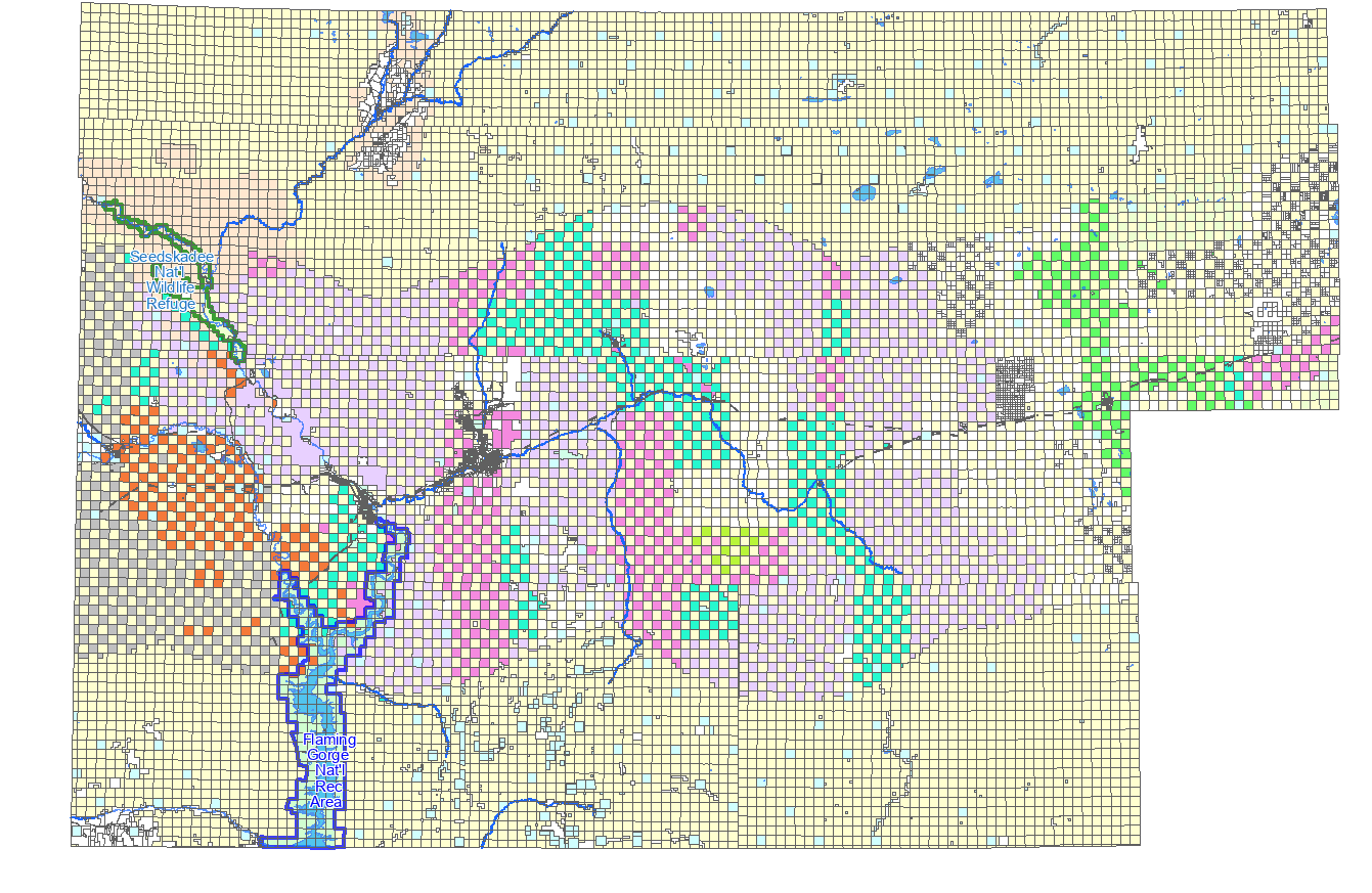
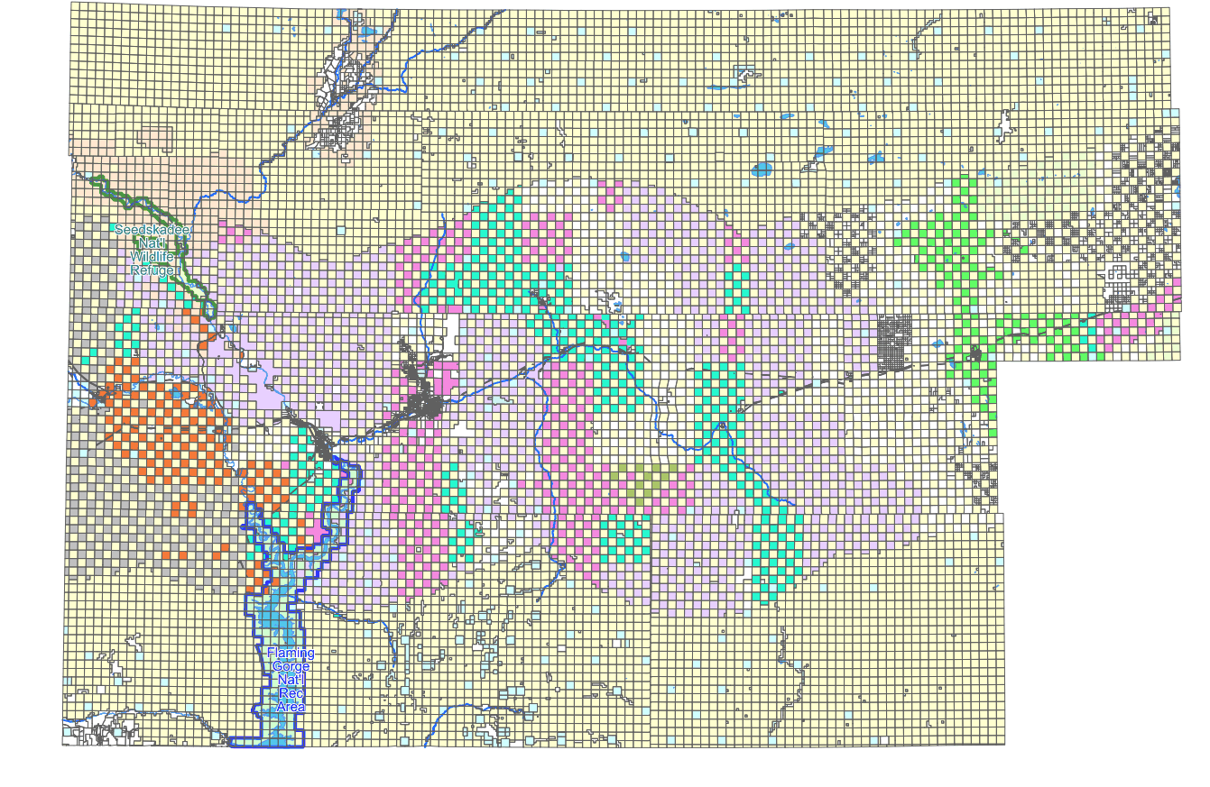
Hi,

I made a few tests with IrfanView and Gimp and it seems that the both images
are antialized but the mapserv76 version is more fine-grained. The mapserv64
version has also less unique colors, 217 vs 250 colors. Saving the mapserv76
image with IrfanView or Gimp by using different settings does not reduce the
file size much so the image obviously really has more details. Interlace mode
(adam7) in Gimp made the image even bigger.
The visual quality of mapserv76.png is not so much better that it would justify
the doubled file size. At least the area with dense rectangles on the right
look better in mapserv64.png. But I fear that for any systematic further
studies you should prepare a test case with source data and mapfile. There are
very many small rectangles in the image and it may be that different
antializing near the narrow black lines makes the difference. It would be
interesting to test the output size with more typical maps.

-Jukka Rahkonen-

Lähettäjä: mapserver-users <mapserver-users-boun...@lists.osgeo.org> Puolesta
Seth G
Lähetetty: maanantai 17. toukokuuta 2021 11.27
Vastaanottaja: Richard Greenwood <richard.greenw...@gmail.com>
Kopio: mapserver-users@lists.osgeo.org
Aihe: Re: [mapserver-users] differing image size with different mapserver
versions

Hi Richard,

In your OUTPUTFORMAT declaration maybe try setting the DRIVER to AGG/PNG8
Also  IMAGEMODE PC256 was only for GD support that was removed in 7.0. Try
IMAGEMODE RGB (or RGBA if you want transparency).

Seth

--
web:http://geographika.co.uk
twitter: @geographika


On Sat, May 15, 2021, at 8:00 PM, Richard Greenwood wrote:
I built from main and tested with ANTIALIAS ON and ANTIALIAS OFF. Assuming that
my mapfile syntax below is correct, there is no difference in size and the
resulting PNG is still approximately 3x larger than the MapServer 6.4 one.
  CLASS
    STYLE
      COLOR 255 255 208
      ANTIALIAS ON
    END
  END
Again, thank you for your suggestions.
Rich

On Sat, May 15, 2021 at 11:21 AM Even Rouault
<even.roua...@spatialys.com<mailto:even.roua...@spatialys.com>> wrote:
Actually, I just tried to open mapserv64.png with gimp, and export it as a
non-interlaced or interlaced PNG. And the non-interlaced version is 60 kB vs 96
kB for interlaced. So interlacing vs non-interlacing isn't the cause here.

Looking more closely at mapserv64.png  vs mapserv76.png , they are visually
different. I suspect the rendering to be of higher quality in 7.6 due to
anti-aliasing and perhaps better quantization to 8-bit. You could perhaps try
to turn off antialiasing in your CLASS.STYLE. This has been re-vived very
recently for AGG line rendering. It is master only however.
Le 15/05/2021 à 19:07, Richard Greenwood a écrit :
Even,

Thank you. I had ignored the difference in the interlacing of the two images
because I didn't think it would have affected the size.

The maprgbapng.c file no longer exists in MapServer 6.4 or 7.6. There is an "if
( interlaced ..." code block in mapoutput.c that is the same in 6.4 and 7.6. I
tried forcing it ON and rebuilding 7.6 but the output image still is not
interlaced. Maybe that code is just a left over. Or maybe AGG doesn't support
interlacing as https://www.mapserver.org/mapfile/outputformat.html seems to
suggest.

In any case, thanks again.
Rich


On Sat, May 15, 2021 at 9:59 AM Even Rouault
<even.roua...@spatialys.com<mailto:even.roua...@spatialys.com>> wrote:

Richard,

your 6.4 image is a interlaced PNG, whereas the 7.6 is a non-interlaced one.

I see in the git history a relevant commit:


$ git show 9984b39cc8f74d60eb240728df660a172a118aad
commit 9984b39cc8f74d60eb240728df660a172a118aad
Author: Thomas Bonfort
<thomas.bonf...@gmail.com><mailto:thomas.bonf...@gmail.com>
Date:   Sun Oct 5 15:59:44 2008 +0000

    rgba_png: don't interlace by default


    git-svn-id: http://svn.osgeo.org/mapserver/trunk@7960
7532c77e-422f-0410-93f4-f0b67bdd69e2

diff --git a/maprgbapng.c b/maprgbapng.c
index 105d8d61..c3615edd 100644
--- a/maprgbapng.c
+++ b/maprgbapng.c
@@ -357,10 +357,13 @@ int msSaveImageRGBAQuantized(gdImagePtr img, gdIOCtx
*ctx, outputFormatObj *form
     int bot_idx, top_idx;
     int remap[256];
     int reqcolors = atoi(msGetOutputFormatOption( format, "QUANTIZE_COLORS",
"256"));
+    const char *interlace;
     ms_png_info info;
     info.width = gdImageSX(img);
     info.height = gdImageSY(img);
-    if( strcasecmp("ON", msGetOutputFormatOption( format, "INTERLACE", "ON" ))
== 0 )
+    interlace = msGetOutputFormatOption( format, "INTERLACE", "OFF" );
+    if( strcasecmp("ON", interlace) == 0 || strcasecmp("YES", interlace) == 0
+            || strcasecmp("1", interlace) == 0)
         info.interlaced=1;
     else
         info.interlaced=0;


But this predates 6.4 release by several years, so this doesn't explain why you
see a different behavior, unless something in 6.4 still turned on interlacing
on in that configuration.

From what I can see in the doc, the interlacing mode was removed in the 7.0
release when GD went off, so I don't think you can do much. I guess that could
be re-added but would require some coding.

Even


Le 15/05/2021 à 17:43, Richard Greenwood a écrit :
I get significantly different image sizes between MapServer 6.4 and 7.6 with
the same output format definition. I've tried many variations of the following.

OUTPUTFORMAT
  NAME "png-test"
  DRIVER "AGG/PNG"  # GD driver is same (6.4 only)
  MIMETYPE "image/png; mode=8bit"
  IMAGEMODE PC256
  FORMATOPTION "QUANTIZE_FORCE=on"
  FORMATOPTION "QUANTIZE_COLORS=256"
  EXTENSION "png"
  # TRANSPARENT on or off makes little difference
END

MapServer 6.4<https://greenwoodmap.com/mapserv64.png> is 90kB, MapServer
7.6<https://greenwoodmap.com/mapserv76.png> is 320kB. Any suggestions as to how
I can get my MapServer 7.6 image sizes down closer to what I'm getting in
MapServer 6.4?

Thanks,
Rich

--

Richard W. Greenwood, PLS
www.greenwoodmap.com<http://www.greenwoodmap.com>


_______________________________________________

mapserver-users mailing list

mapserver-users@lists.osgeo.org<mailto:mapserver-users@lists.osgeo.org>

https://lists.osgeo.org/mailman/listinfo/mapserver-users


--

http://www.spatialys.com

My software is free, but my time generally not.


--

Richard W. Greenwood, PLS
www.greenwoodmap.com<http://www.greenwoodmap.com>

--

http://www.spatialys.com

My software is free, but my time generally not.


--
Richard W. Greenwood, PLS
www.greenwoodmap.com<http://www.greenwoodmap.com>
_______________________________________________
mapserver-users mailing list
mapserver-users@lists.osgeo.org<mailto:mapserver-users%40lists.osgeo.org>
https://lists.osgeo.org/mailman/listinfo/mapserver-users
_______________________________________________
mapserver-users mailing list
mapserver-users@lists.osgeo.org
https://lists.osgeo.org/mailman/listinfo/mapserver-users