Hello,
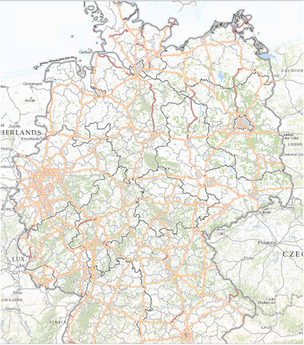
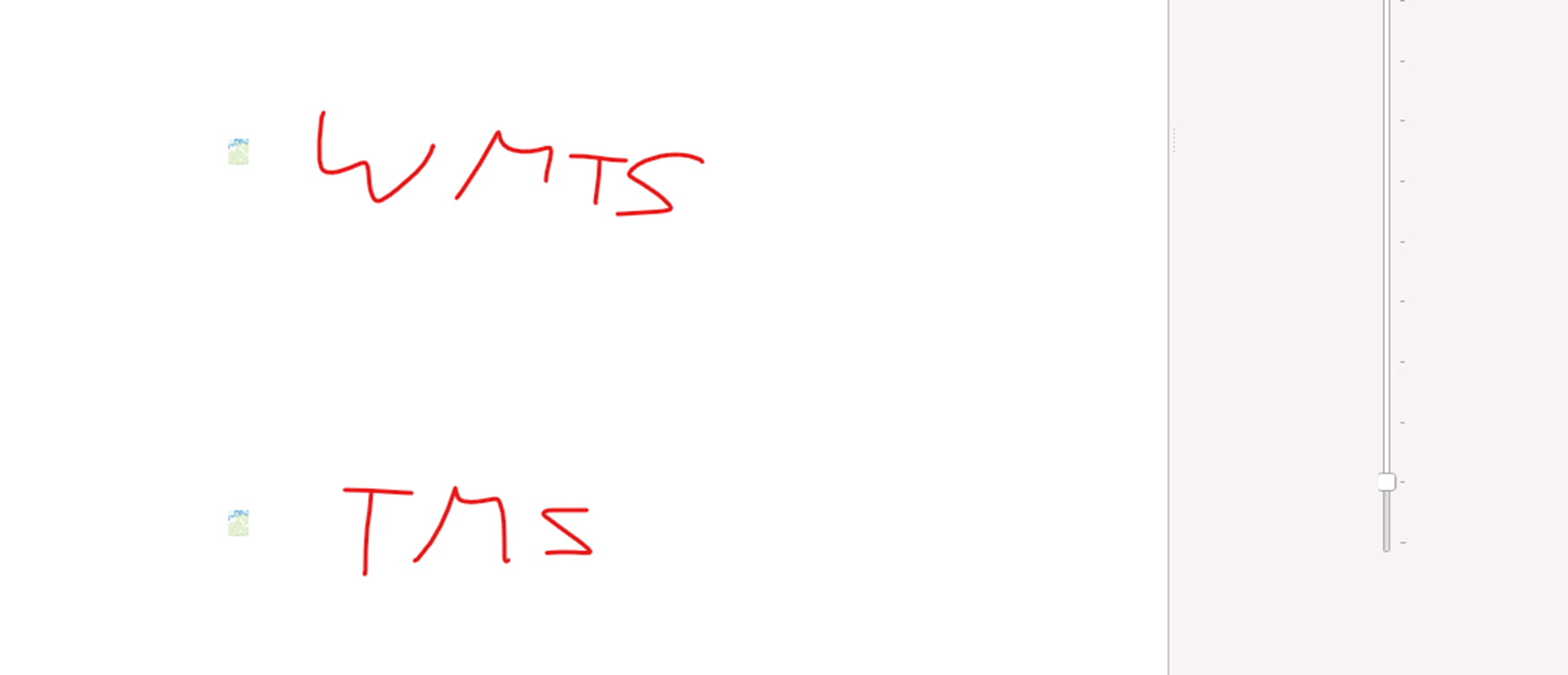
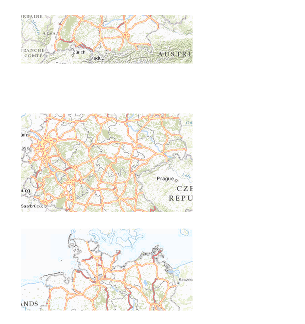
i have another hint maybe.

The source is a mapproxy layer where the source of the mapproxy layer has a
GLOBAL_WEBMERCATOR grid --> EPSG:3857 and origin north-west (top-left).

I don’t know how to configure mapcache and mapproxy that the output of that
layer gets a bottom-left origin since tms only supports bottom-left.

So we know the issue is that we have different origins at source and target.

Maybe you know how I should configure it.

Thanks in advance.


Von: Travis Kirstine <traviskirst...@gmail.com
<mailto:traviskirst...@gmail.com> >
Gesendet: Dienstag, 11. April 2023 20:44
An: STEINER Andreas < <mailto:astei...@eurofunk.com> astei...@eurofunk.com>;
mapserver-users < <mailto:mapserver-users@lists.osgeo.org>
mapserver-users@lists.osgeo.org>
Betreff: [EXTERN]Re: [MapServer-users] WG: mapcache tms it not working properly


Sie erhalten nicht oft eine E-Mail von  <mailto:traviskirst...@gmail.com>
traviskirst...@gmail.com.  <https://aka.ms/LearnAboutSenderIdentification>
Erfahren Sie, warum dies wichtig ist


My guess <origin>top-left</origin> is your issue, I believe the tms standard is
for bottom-left


On Tue, 11 Apr 2023 at 08:44, STEINER Andreas < <mailto:astei...@eurofunk.com>
astei...@eurofunk.com> wrote:

Hello everyone,


I set up a mapcache layer for a customer of mine.
The layer looks like this:


<https://eur03.safelinks.protection.outlook.com/?url=https%3A%2F%2Fuser-images.githubusercontent.com%2F59861665%2F231165591-1fb8d097-70e1-487d-91c6-152291b3ae43.png&data=05%7C01%7Casteiner%40eurofunk.com%7Cdf03d26da26b45637bd208db3b1db2cb%7C6d4fa94918de4214a28c3e8c7fa9c25b%7C0%7C0%7C638169639115429132%7CUnknown%7CTWFpbGZsb3d8eyJWIjoiMC4wLjAwMDAiLCJQIjoiV2luMzIiLCJBTiI6Ik1haWwiLCJXVCI6Mn0%3D%7C2000%7C%7C%7C&sdata=my5qLpPpw0gdE6FW8aEz6g3VdUqhUn%2BV4d5UJhJW2H0%3D&reserved=0>

https://user-images.githubusercontent.com/59861665/231165591-1fb8d097-70e1-487d-91c6-152291b3ae43.png


When requesting the layer via wmts or wms everything works fine.
My customer requires TMS – when I request the tiles with tms the tiles are not
at the right place.


Z0: At Z0 the tiles match:


<https://eur03.safelinks.protection.outlook.com/?url=https%3A%2F%2Fuser-images.githubusercontent.com%2F59861665%2F231165657-742f7944-f2a4-444c-9a82-24c10574bdc8.png&data=05%7C01%7Casteiner%40eurofunk.com%7Cdf03d26da26b45637bd208db3b1db2cb%7C6d4fa94918de4214a28c3e8c7fa9c25b%7C0%7C0%7C638169639115429132%7CUnknown%7CTWFpbGZsb3d8eyJWIjoiMC4wLjAwMDAiLCJQIjoiV2luMzIiLCJBTiI6Ik1haWwiLCJXVCI6Mn0%3D%7C2000%7C%7C%7C&sdata=Uvn%2FQE5RrO%2FBghsTx7R%2F9suGgSQ%2FL8C71U5Fk%2FimXDI%3D&reserved=0>

https://user-images.githubusercontent.com/59861665/231165657-742f7944-f2a4-444c-9a82-24c10574bdc8.png


At Z1 they are not at the same place:

<https://eur03.safelinks.protection.outlook.com/?url=https%3A%2F%2Fuser-images.githubusercontent.com%2F59861665%2F231165693-29e2399a-04cd-4df0-b63a-1ab3f606ce92.png&data=05%7C01%7Casteiner%40eurofunk.com%7Cdf03d26da26b45637bd208db3b1db2cb%7C6d4fa94918de4214a28c3e8c7fa9c25b%7C0%7C0%7C638169639115429132%7CUnknown%7CTWFpbGZsb3d8eyJWIjoiMC4wLjAwMDAiLCJQIjoiV2luMzIiLCJBTiI6Ik1haWwiLCJXVCI6Mn0%3D%7C2000%7C%7C%7C&sdata=kfCNWkGnmxtuIMNPm7B2AzYgAePOZyIjXw5%2Fd%2B1hU%2Fk%3D&reserved=0>

https://user-images.githubusercontent.com/59861665/231165693-29e2399a-04cd-4df0-b63a-1ab3f606ce92.png

And e.g. at Z6 it looks like this:


<https://eur03.safelinks.protection.outlook.com/?url=https%3A%2F%2Fuser-images.githubusercontent.com%2F59861665%2F231165727-a638e7d8-8803-4c81-a2bd-7ff70ed04020.png&data=05%7C01%7Casteiner%40eurofunk.com%7Cdf03d26da26b45637bd208db3b1db2cb%7C6d4fa94918de4214a28c3e8c7fa9c25b%7C0%7C0%7C638169639115429132%7CUnknown%7CTWFpbGZsb3d8eyJWIjoiMC4wLjAwMDAiLCJQIjoiV2luMzIiLCJBTiI6Ik1haWwiLCJXVCI6Mn0%3D%7C2000%7C%7C%7C&sdata=OYKHZx9vLqNQ17tQMu8QLrTfP%2BSFC4JxBJZWhKxXGFg%3D&reserved=0>

https://user-images.githubusercontent.com/59861665/231165727-a638e7d8-8803-4c81-a2bd-7ff70ed04020.png


That’s the configuration for the GRID:

  <grid name="WORLD">

      <metadata>

        <title>GoogleMapsCompatible</title>


<WellKnownScaleSet>urn:ogc:def:wkss:OGC:1.0:GoogleMapsCompatible</WellKnownScaleSet>

      </metadata>

      <extent>-20037508.3427892480 -20037508.3427892480 20037508.3427892480
20037508.3427892480</extent>

      <srs>EPSG:3857</srs>

      <size>256 256</size>

      <srsalias>EPSG:900913</srsalias>

      <origin>top-left</origin>

      <resolutions>156543.03392800014 78271.51696399994 39135.75848200009
19567.87924099992 9783.93962049996 4891.96981024998 2445.98490512499
1222.992452562495 611.4962262813797 305.74811314055756 152.87405657041106
76.43702828507324 38.21851414253662 19.10925707126831 9.554628535634155
4.77731426794937 2.388657133974685 1.1943285668550503
0.5971642835598172</resolutions>

  </grid>


I also tried to use a EPSG:4326 with a extend -180 -180 180 180 but it’s the
same result.

The url I used looks like this:
<http://XX%20/mapcache/tms/1.0.0/%3ctileset%3e@WORLD/%7bz%7d/%7bx%7d/%7by%7d.png>
 http://XX /mapcache/tms/1.0.0/<tileset>@WORLD/{z}/{x}/{y}.png

Maybe someone has an idea why it doesn’t work.


Thanks in advance.


Best regards

Andy
![]() smime.p7s
smime.p7s
Description: S/MIME Cryptographic Signature
_______________________________________________
MapServer-users mailing list
MapServer-users@lists.osgeo.org
https://lists.osgeo.org/mailman/listinfo/mapserver-users