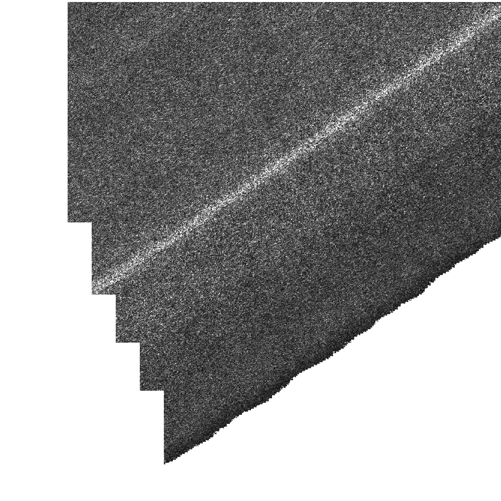
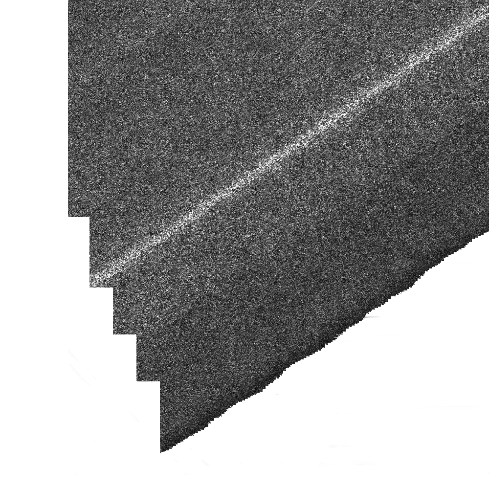
Hi everyone !

I am trying to use MapServer to serve images at full resolution, but right
now the images I receive from MS are a little different from what is in the
input's files.
The whole image seems to be correct but by looking closer, one can see that
a vertical line has been inserted in the result.
In order to achieve this, my request to the server does not include the BBOX
in order to receive the whole extent served by the server. The requested
width and length are equal to those of the mapfiles.
The Layer is composed of one Tiff file georeferenced with a tfw file.
The extent of the Map is equal to the extent of the tfw file.
The projection are the same in the layer and in the input.

The line that is inserted in the resulting output does not seem to come from
the input neither seems to be an interpolation of the input.

As a second test, I tried to offset my extent by half the resolution of my
input but in this output we can now see that a set of vertical lines is
offseted.

You can see my input and output :
http://benoit.andrieu.free.fr/images/input.png
http://benoit.andrieu.free.fr/images/output_1.png
http://benoit.andrieu.free.fr/images/output_2.png

As you'll see the difference is very small but I need to not have this
difference.

Does someone has any clue where the difference could be ?

Thanks in advance !
Benoît