Hi Tim,

Sorry, I missed this email from you.
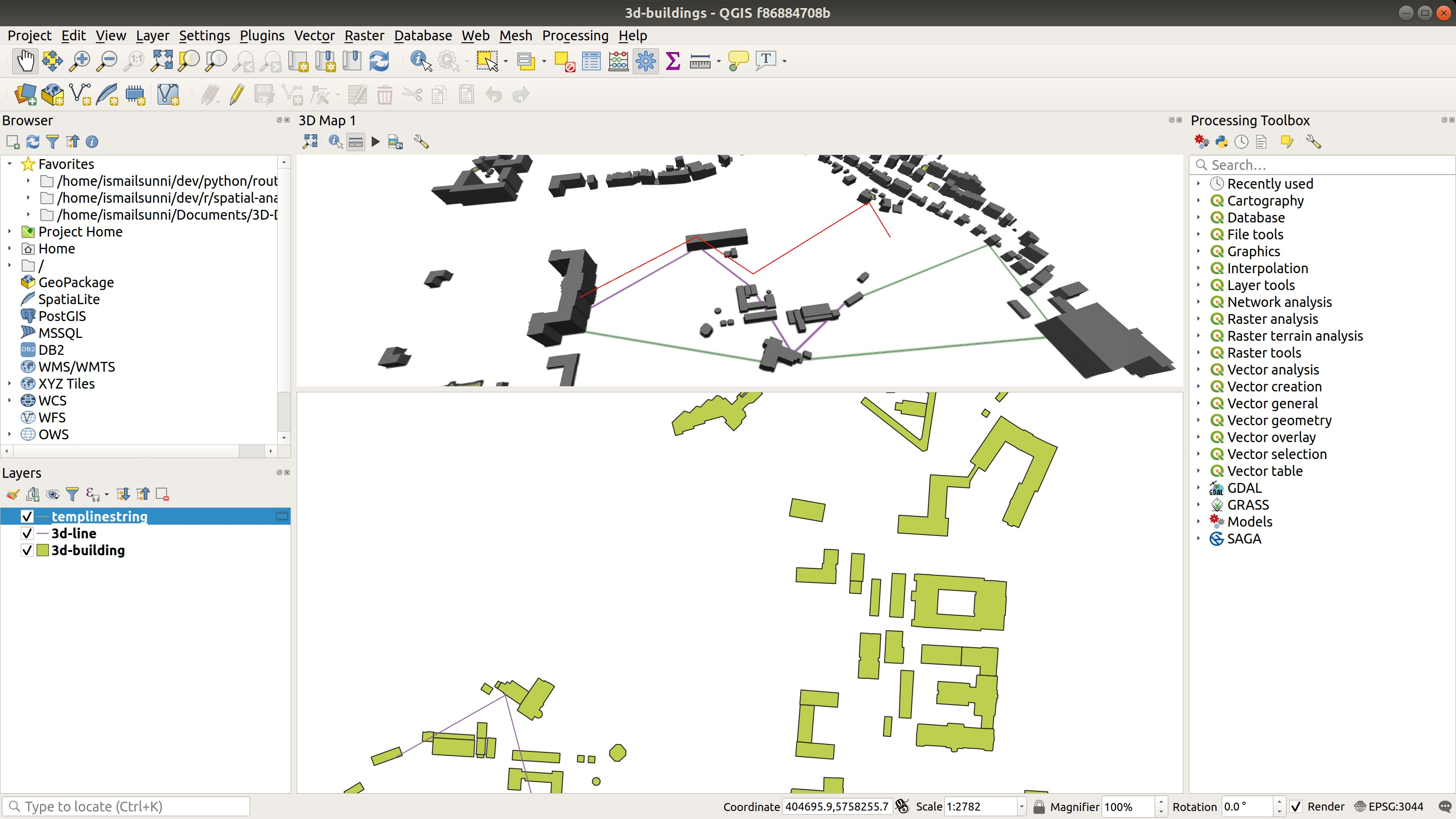
Thanks for the update Sunni! Do measurements happen in 3d too? For example > if you measure to the top of a building do you get a different measurement > compared to the base? Yes, the measurements happen in 3D. You can measure the building height now :) > Maybe you could show the Z elevation change at each measurement row and > the total elevation change in the total box? Hmm, that's a good idea. I will keep it on my list, and I will try to implement it after the other 2 features finished. Thanks! Hope you are feeling better now! Thanks, I am feeling better indeed now :) Best regards On Sun, Jun 23, 2019 at 8:34 PM Tim Sutton <t...@kartoza.com> wrote: > Thanks for the update Sunni! Do measurements happen in 3d too? For example > if you measure to the top of a building do you get a different measurement > compared to the base? Maybe you could show the Z elevation change at each > measurement row and the total elevation change in the total box? > > Hope you are feeling better now! > > Regards > > Tim > > On 23 Jun 2019, at 15:29, Ismail Sunni <imajimat...@gmail.com> wrote: > > Dear QGIS developers, > > Here is my 3rd-week report for my GSoC Project. You can read this report > better with image and GIF in the weekly report wiki [6]. You can also check > the project wiki page [3]. Comments and suggestions are welcome :) > > GSoC QGIS 3D Improvement Week 4 Report > > *Period*: 17 June 2019 - 23 June 2019 > > *Report* > 1. What did I complete this week? > - Replicate UI from 2D measurement tool to the 3D measurement tool > dialog. > Almost all functionalities are replicated, except: > - Show help (the behavior is added, but since there is no chapter for > it currently. It's disabled for now) > - Configuration (already started working on it, but time is quite > limited last week since I feel a little bit unwell last week) > > List of implemented behaviors can be found in [4]. You can see it on > a GIF [5]. >  > - Adding map tool for camera control in 3D view (similar to the Pan > tool in 2D view) to make it more consistent and easier to see what's the > active tool. > - Change the cursor for 3D identify tool for consistency with 2D one. > - Adding missing `QgsDistanceArea::MeasureLine3D` for `QgsPoint`, unit > test is added. > - Trying to fix the rendering issue, but still no luck. > 2. What am I going to achieve for next week? > - Finish the configuration > - Try again with the rendering issue > - Wrap up PR if the all is finished (currently a draft) > - Some testing > - Start working on the 3rd feature, point as a billboard. > 3. Is there any blocking issue? > - Yes, the line is rendered but the color is random and rendered as 2D. > The line will be gone if I hide/show another line [2]. >  > 4. Code > - Branch in my repo [1] > 5. Misc > - N/A > > *References* > - [1] https://github.com/ismailsunni/QGIS/tree/measurement-tool > - [2] https://github.com/ismailsunni/QGIS/issues/2#issuecomment-502470762 > - [3] Project Wiki: > https://github.com/ismailsunni/QGIS/wiki/GSoC-2019---QGIS-3D-Improvement > - [4] https://github.com/ismailsunni/QGIS/issues/2#issuecomment-504750318 > - [5] > https://user-images.githubusercontent.com/1421861/59976840-2a78c100-95ca-11e9-9e32-16b6c34b4ce9.gif > - [6] https://github.com/ismailsunni/QGIS/wiki/Week-4-Report > > Best regards > > -- > Ismail Sunni > ismailsunni.wordpress.com > _______________________________________________ > QGIS-Developer mailing list > QGIS-Developer@lists.osgeo.org > List info: https://lists.osgeo.org/mailman/listinfo/qgis-developer > Unsubscribe: https://lists.osgeo.org/mailman/listinfo/qgis-developer > > > — > > > > > > > > > *Tim Sutton* > > *Co-founder:* Kartoza > *Ex Project chair:* QGIS.org > > Visit http://kartoza.com to find out about open source: > > Desktop GIS programming services > Geospatial web development > GIS Training > Consulting Services > > *Skype*: timlinux > *IRC:* timlinux on #qgis at freenode.net > > I'd love to connect. Here's my calendar link > <https://calendly.com/timlinux> to make finding time easy. > > -- Ismail Sunni ismailsunni.wordpress.com
_______________________________________________
QGIS-Developer mailing list
QGIS-Developer@lists.osgeo.org
List info: https://lists.osgeo.org/mailman/listinfo/qgis-developer
Unsubscribe: https://lists.osgeo.org/mailman/listinfo/qgis-developer