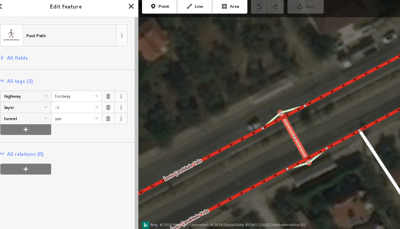
Hello,

I've added a pedestrian tunnel under a main road in Turkey:
https://www.openstreetmap.org/#map=19/39.54963/26.61832
http://troels.arvin.dk/osm/evidence/turkey/ped_tun/osm-editor-ss.png
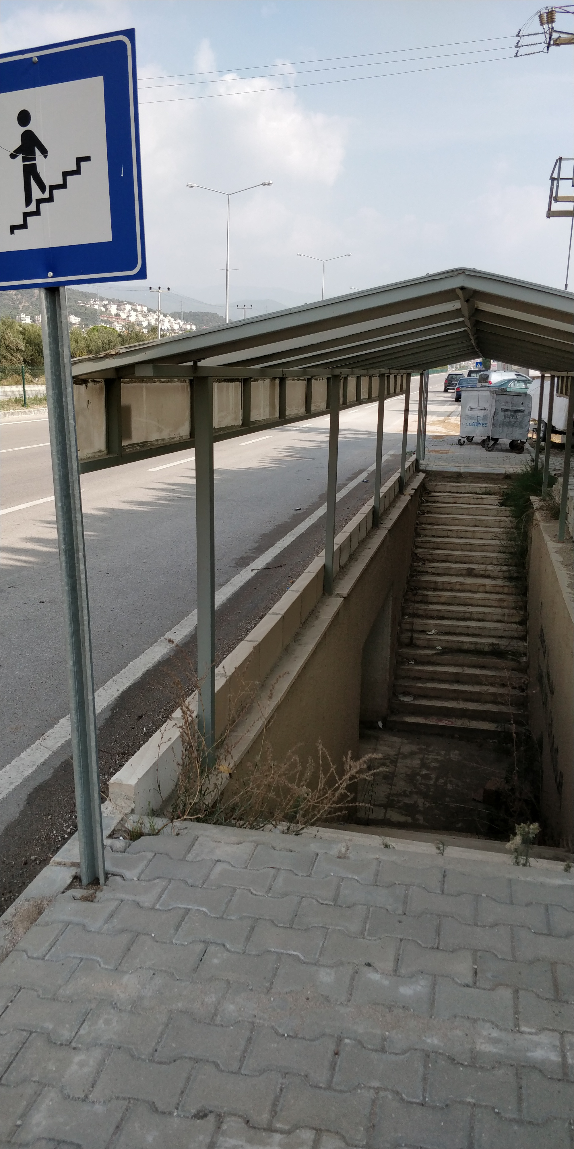
This is what it looks like in the real world:
http://troels.arvin.dk/osm/evidence/turkey/ped_tun/foto.jpg

However, GraphHopper doesn't seem to consider the tunnel.
Note how it takes the walking person on a long detour:
http://troels.arvin.dk/osm/evidence/turkey/ped_tun/osm-graphhopper-ss.png

Have I tagged it in a wrong way? Or does GraphHopper have a delay in data-
uptime which explains why it does not suggest using the tunnel when being
on foot? Or is this a GraphHopper bug which needs to be reported (where?)?

--
Regards,
Troels Arvin <[email protected]>
http://troels.arvin.dk/


_______________________________________________
Routing mailing list
[email protected]
https://lists.openstreetmap.org/listinfo/routing