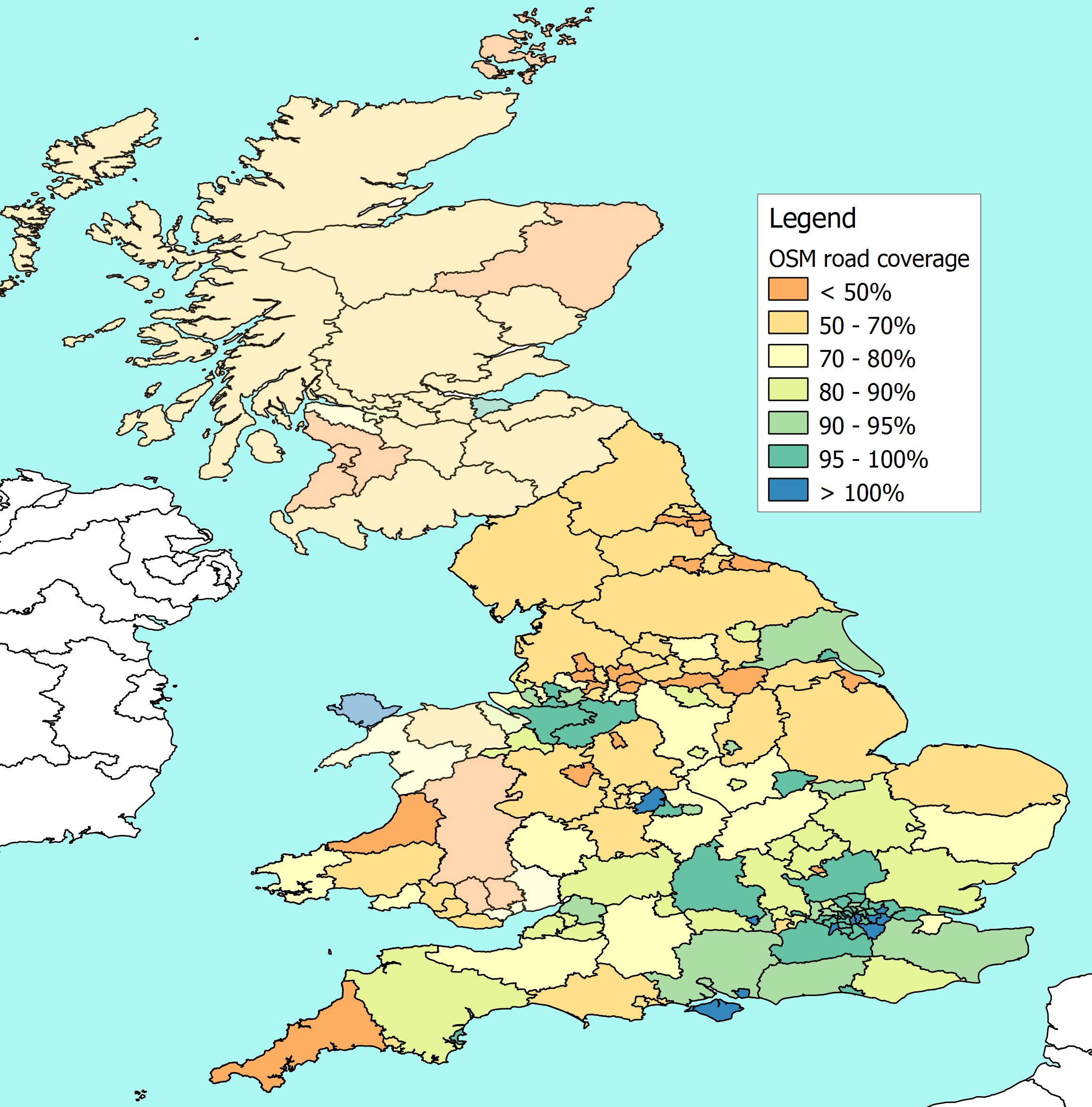
I've uncovered and fixed a few errors in my previous estimates of the % of
UK roads included on OSM.
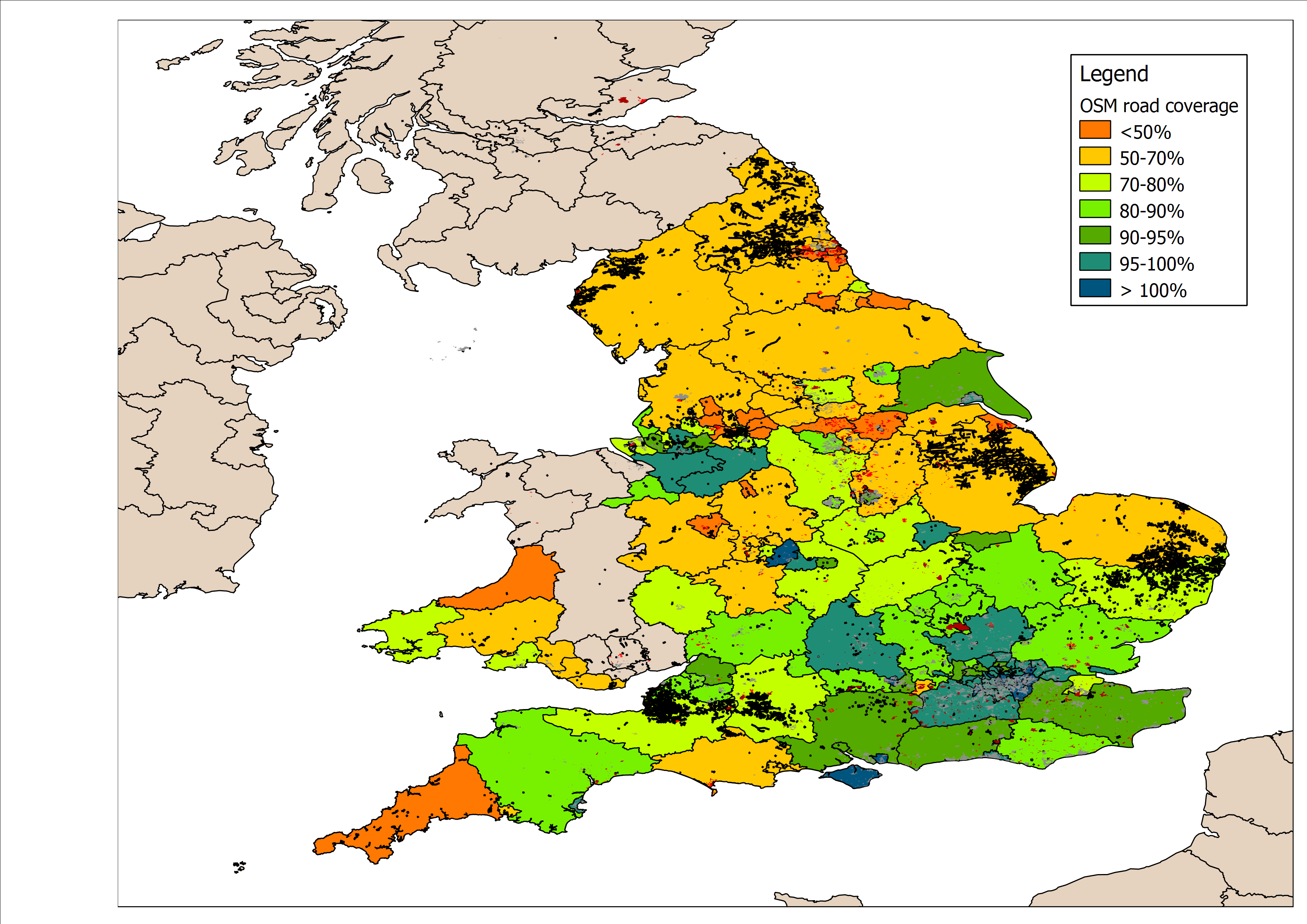
I discovered a few days ago that there were a few areas where different
boundaries overlapped, with the result that I was double counting some roads
in more than one local authority. The problem areas included Rochdale,
Thurrock, Stoke and Derby.


I think I've fixed them now, and the updated map is here -
http://www.reedhome.org.uk/Documents/OSMCover.png


Unfortunately I extracted the revised data a day too early to pick up the
new admin boundaries in Wales.

But at least the data in map and the spreadsheet here -
http://www.reedhome.org.uk/Documents/OSMCoverage.csv - is a little more
accurate than it was.


I've also been experimenting with ways to flag up residential areas that
don't seem to have enough roads plotted, and to highlight roads that haven't
been fully tagged.

My first attempt is crude, but if anyone is interested, the map is here -
http://www.reedhome.org.uk/Documents/OSMCover%20with%20extras.png

(roads that are only classified as "highway=road" or highway=fixme" are in
plotted in black, and the little red splodges show area that are marked as
"landuse=residential" but have a very low density of roads within them)


I've not forgotten the helpful hints on improving the colour scheme, I still
want to find a way to use the NUTS boundaries, I'd like to find a way of
speeding the whole process up, and I'll pick up better data for Wales next
time.


I'd also like to find a way to trim each local authority  at the coastline
to make it look a bit better...


...but one thing at a time, and it seemed more sensible to fix blatant
errors.
_______________________________________________
Talk-GB mailing list
Talk-GB@openstreetmap.org
http://lists.openstreetmap.org/listinfo/talk-gb