Hi!

I saw the news about the new API, and thought I'd mention that while it's
originally intended as a web map, there are other possible uses for it.
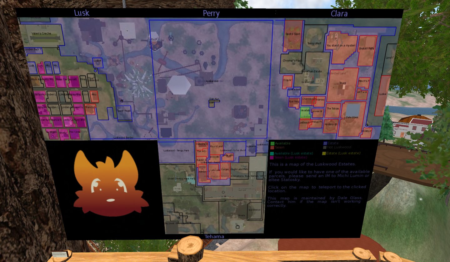
For instance, here's the new project I've been working on:

http://daleglass.net/images/screenshots/estate_map_001.jpg
(the weird angle is due to an inconveniently placed object in front of it)

Luskwood offers land to whoever wants it, in exchange for a tier donation to
a group. Land is group owned and not sold to the resident.

Due to this, it's hard to keep track of what's reserved and not. People who
want land often get told "I don't know", because there's nothing in SL that
reflects what is used and by who, so very few people are up to date on which
land is available, where and of what size. So I made a map that updates
every day to help solve that problem.

Every day, a bot logs in, and generates parcel data. A script downloads map
tiles and draws an overlay. Bot uploads each of those as a texture, and
updates a database. The in-world map uses HTTP requests to request the
latest texture UUID. It can be clicked to open the map at the clicked
location.

This can be currently found on the platform in Lusk. Feel free to come and
try it. Luskwood is a furry area, but all kinds of avatars are welcome.

Now unfortunately while making this I found that there's no ideal way of
getting it done.

I don't want to use a web map because I want residents to see immediately
what land is available without going to some website and checking. I also
think that as cool as the web ones are, things should be kept inside SL,
and not outside it when possible.

Using HTML media doesn't work that great either, as many people have it
disabled, there can be only one per parcel, and it's limited to 1024x1024.
And with just one prim I could dedicate to it, there are size limits and
the need to figure out what the user clicked on.

The current menthod isn't ideal either, because I have to pay for every
texture upload, though this is compensated for by keeping a list of md5
hashes of the generated images and associated UUIDs, in case a previously
seen configuration reappears.


So, getting back ontopic. I really like that I can do this, but for this
particular usage, a few things could be better.

Will there be other types of tiles besides -objects? A tile containing only
land could be useful. Ideally I'd like to have overlays for everything that
can be seen in the map in the viewer. It would be nice to draw the
locations of the events on the map as well for instance, without requiring
a bot to do that job.

Bigger tiles would be nice. 256x256 is big enough for a web map, but when
trying to draw parcel names on top of that it's too small, so I had to
scale up to 512x512.

Unlike web users, I'd rather have everything be as big and high quality as
possible. I can always easily shrink things that are too big, and apply the
jpeg2000 compression only after everything is done. If overlays are done,
please do them as PNGs.
![]() signature.asc
signature.asc
Description: This is a digitally signed message part.
_______________________________________________
Policies and (un)subscribe information available here:
http://wiki.secondlife.com/wiki/SLDev
Please read the policies before posting to keep unmoderated posting privileges