"Here’s an example of a square in Berlin in a residential early 20th
century area:"
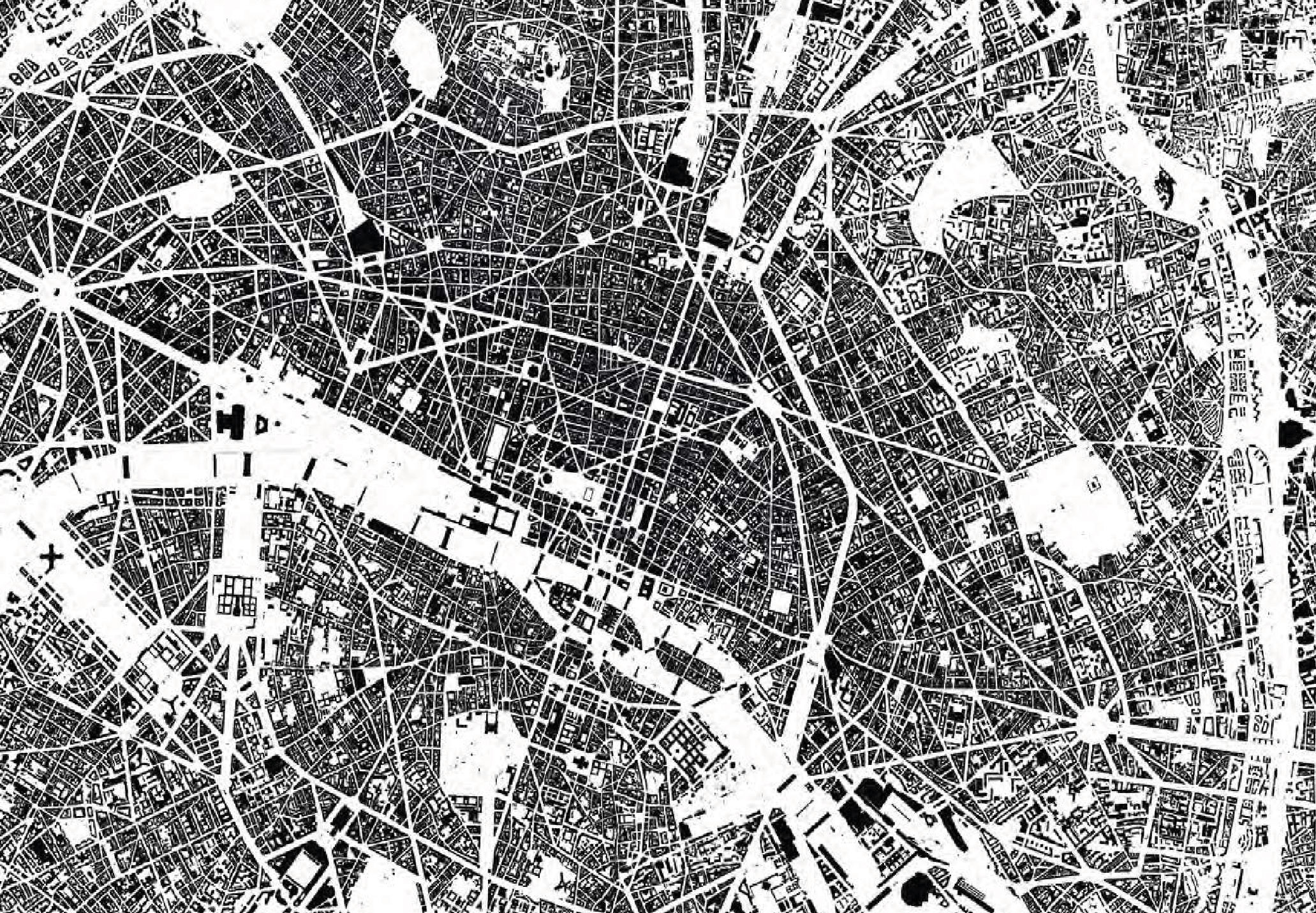
Is this mapped as a leisure=park in Openstreetmap? If so, then I don't
see any need to also map the same area as a square.

> I would still count them in, or we will end up splitting hair about how much
> of a square must be paved in order to be a square.

Why is this a problem? When mapping areas with some trees, a mapper
must decide how much of the ground is covered by tree canopy to make
it a woodland (natural=wood) instead of a grassland savana
(natural=grassland) or pasture with a few trees (landuse=meadow).

Mappers always have to make decisions on border cases, and usually the
decision will come down to "what is most of the area covered with?"

-- Joseph Eisenberg

On 3/24/20, Martin Koppenhoefer <dieterdre...@gmail.com> wrote:
>
>
> sent from a phone
>
>> On 23. Mar 2020, at 15:07, Joseph Eisenberg
>> In Indonesia an "alun-alun" is never small, they are always rather
>> large to very large open areas.
>
>
> so these are likely not the only kind of squares in Indonesia (if you decide
> they are squares at all, or some of them), there will probably also be
> smaller ones.
>
>
>>
>> Many are grassy fields with a few trees, planted north and south of an
>> old palace, or as a parade ground for the military back in the
>> colonial era, and these are mostly tagged as leisure=park, because
>> they are grass and trees now. These are mainly for recreation and for
>> looking nice.
>>
>> Some are now playing fields, like soccer pitches + volleyball /
>> basketball courts
>>
>> A few are still police/military parade grounds (not many), grass or
>> grass/dirt.
>>
>> But some have pavement (often pavers, sometimes bricks, concrete,
>> asphalt, stone etc) and are used for temporary markets, rallies,
>> public events, etc. - these seem similar to a European square.
>
>
> seems so by this description, although festival grounds would typically not
> fall in the square definition IMHO.
>
> I’m unsure about military parade grounds, but would tend to include them
> (thinking of central open areas used for mustering and surrounded by
> barracks)
>
>
>>
>> Should I map all of these as "place=square" since "square" =>
>> "alun-alun", even though many of these alun-alun could be a
>> leisure=park, leisure=garden, leisure=pitch instead?
>
>
> You should get rid of the either or idea, they can be both (or squares can
> contain areas which are gardens, parks, maybe pitches. Actually I would
> exclude dedicated sports grounds generally but there could be exceptions.
>
>
>>
>> "You would usually need to see the context in order to understand
>> whether these are just parks or parks on squares."
>>
>> So what about the context will tell me whether or not it is a
>> place=square?
>
>
> their position in the road network and the surrounding areas (is it inside a
> built up area?)
>
>
>> It can't be out in the countryside, can it?
>
>
> within a village or maybe even hamlet yes, in the open countryside usually
> no.
>
>
>> Or a parade
>> ground in a military base?
>
>
> maybe
>
>
>> A grass lawn in the middle of an apartment
>> complex?
>
>
> no
>
>
>> A patio in a park?
>
>
> I don’t understand this meaning of patio, can you post an example? A patio
> to me means an open space inside a block of buildings or within a building
> (inner courtyard)
>
>
>>
>> I think there should be a practical, physical definition of what is a
>> place=square. If it doesn't have to be hardscaped (whether paved or
>> just packed soil), should it at least lack tall vegetation which
>> blocks views and movement?
>
>
> It could have tall vegetation as a means of structuring it, or to separate
> it from surrounding streets, but this would usually be partial and allow
> passing.
>
>
>>
>> Perhaps a flat area with mostly short grass can still be a square, but
>> certainly not if it is mostly covered by trees, shrubs and flower
>> beds.
>
>
> Here’s an example of a square in Berlin in a residential early 20th century
> area:
>
>
> http://www.stern-berlin.com/assets/content/images/stadtquartiere/stadterneuerung/SG-Kollwitzplatz-Luftbild.jpg
>
> https://media-cdn.tripadvisor.com/media/photo-s/0f/e5/cd/c8/photo1jpg.jpg
>
> https://commons.m.wikimedia.org/wiki/Category:Kollwitzplatz_(Berlin-Prenzlauer_Berg)
>
>
> It boasts all of the features you mention (scrubs, tall trees, etc.)
> From my understanding, the square polygon would share nodes with the
> surrounding buildings, while the park/garden is contained, but smaller (the
> square minus the outer sidewalk minus the street minus the inner sidewalk).
>
>
>> That's a park or garden, even if it is called "Plaza de Armas"
>> or "Old Village Square".
>>
>
>
> I agree that these cases could eventually be questioned, one could argue
> they have been squares before and are now parks. I would still count them
> in, or we will end up splitting hair about how much of a square must be
> paved in order to be a square.
>
> WRT pedestrian spaces, here’s the centre of Paris in a Nolliplan:
> http://www.iad-bs.de/site/assets/files/1954/schwarzplan.jpg
> All the areas where the streets widen significantly at junctions with other
> streets are likely squares (you can’t see the smaller ones in this scale).
> The surrounding buildings will often accentuate the square (raised corners,
> main facade to the square etc.)
> Usually there will be a relationship of streets and squares.
>
> Another type of squares are those in front of
> significant/important/monumental buildings (e.g. churches, public buildings
> like town halls, train stations, parliaments, castles, ...)
>
> Cheers Martin
>
>

_______________________________________________
Tagging mailing list
Tagging@openstreetmap.org
https://lists.openstreetmap.org/listinfo/tagging