On 28/07/2020 16.09, Paul Allen wrote:
On Tue, 28 Jul 2020 at 20:44, Matthew Woehlke wrote:
Please see https://www.openstreetmap.org/way/651244930. This is a pier
with a platform on land that extends into the water. Carto cuts off the
part that is on land.
There is no part of a pier on land.  Not according to the wiki: "A pier is
a raised
walkway over water..."
Really?

Let's look at some pictures:

https://mediaassets.ksby.com/cordillera-network/wp-content/uploads/sites/2/2019/04/26205653/PierToday-e1556337486552.jpg
https://cloudfront-us-east-1.images.arcpublishing.com/raycom/X3EB5BF765G5TFHPOBGNDEJIJQ.jpg
https://arc-anglerfish-arc2-prod-pmn.s3.amazonaws.com/public/AY3CHTOCXNDWDHJJD2A73ICBF4.jpg
https://www.fishanywhere.com/wp-content/uploads/2019/08/crystal-coast17-229.jpg
What you are saying (okay, maybe what the wiki is saying) is that all of
these magically cease to be piers at the coastline and become... what?
I don't think most people share that view.
BTW, Wikipedia defines a pier as "a raised structure that rises above a
body of water *and usually juts out from its shore*" (emphasis added). I
would expect that most people would interpret the "pier" in the above
images as being the entire contiguous surface from the end in the water
until either a) where the support framework ceases, or at least b) the
narrower section ends at a wider deck.
I have to agree with others; the wiki is wrong. (And I think carto is
also wrong about the render order; military areas certainly can have
piers, so rendering in a way which makes them impossible to see is
unhelpul.)
On 28/07/2020 18.23, Paul Allen wrote:
> Or maybe I've seen floating piers. :)
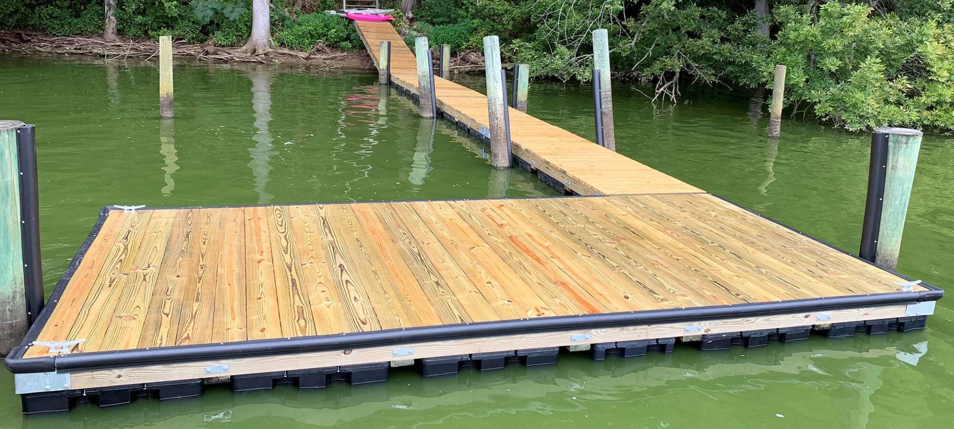
Even floating piers may have sections on land:
https://cdn.shopify.com/s/files/1/0056/4376/3801/products/10x8_Aluminum-Framed_Floating_Dock_with_Pond_King_Sport_Mini_Pontoon_Boat_grande.jpeg
https://chesapeakedock.com/app/uploads/2020/02/garido-floating-pier-1.jpg
https://i.pinimg.com/736x/e0/c5/0a/e0c50a27ceaf9b3ef12a54f6571284ff.jpg
https://cdn.shopify.com/s/files/1/0056/4376/3801/products/8x8-8ft-walkway_grande.jpg
https://www.goldenboatlifts.com/wp-content/uploads/2017/10/IMG_0092.jpg
...unless you insist on separately modeling the connecting section as a
bridge. (Which I will concede is feasible in *some* cases. Even in my
example, if I knew how to tag the on-land part, but less so in the
examples given above in this message.)
(On a related note, this makes me think we should have pier type tags...)
So... back to my *other* question: how should a raised wooden platform
on land be tagged? For example:
https://www.pitztal.com/sites/default/files/styles/adaptive/public/thumb_5101_lightbox.jpeg
https://upload.wikimedia.org/wikipedia/commons/e/e2/Laguna_Mountains%2C_California%2C_observation_area_2015.jpg

--
Matthew

_______________________________________________
Tagging mailing list
Tagging@openstreetmap.org
https://lists.openstreetmap.org/listinfo/tagging