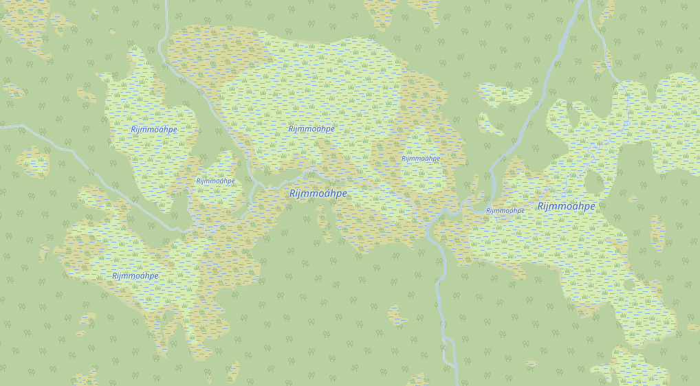
For reference, here's Rijmmoáhpe again, a wetland which is about 4 km
across, consisting of both bog and marsh:
https://www.torger.se/anders/downloads/Screenshot_2020-12-13-OpenStreetMap.png
It's located in Muddus national park, Sweden.
I'm quite sure the recommendation Christoph refers to is simply to put
names on each separate part, which is seen in the screenshot. It's
unclear to me if this is seen by Christoph and others as a final and
good solution, or just as "the best we can do for the moment". So I hope
to get a clarification on that.
Personally I see it as "the best we can do for the moment", but think
that it of course should be rendered as a single name, and as such the
name tag should not really be on each separate part, but on a relation.
Sure a renderer could trace around and scan for neighboring areas with
the same name and automatically, calculate the area of each part to find
out the dominant nature type (required for name tag styling), and place
a single name, but to me it does not seem like a proper way to arrange
geo data for a single named natural entity.
So what I have done in addition is to create a relation with
type=natural; natural=wetland; name=Rijmmoáhpe with all the parts as
members (role field unset). If that is just too controversial, I can
skip that and leave with just naming the parts. I planned to do that at
first, but as some of these natural features are quite heavily
fragmented in small pieces just for a management point of view in JOSM I
found this relation to be practical thing to have, so I added it.
There's a whole family of unanswered questions regarding to names of
nature. If Martin's fuzzy area concept was accepted and used
https://github.com/dieterdreist/OpenGeographyRegions maybe many of these
features would use that instead. Or maybe if place=locality concept on
points was developed and diversified that could be used instead. I don't
have any strong opinions on which method to use, I just want to be able
to map with high detail and high quality and use any method that works.
On 2020-12-14 10:05, Ture Pålsson via Tagging wrote:
13 dec. 2020 kl. 16:15 skrev Christoph Hormann <o...@imagico.de>:
I am trying to understand what the issue is with the recommendation
for mapping you have received from multiple sides here.
Just to clarify, could you summarise what that recommendation is, for
the Rijmmoáhpe case? The thread has become a little unwieldy (partially
my fault... sorry about that!).
_______________________________________________
Tagging mailing list
Tagging@openstreetmap.org
https://lists.openstreetmap.org/listinfo/tagging
_______________________________________________
Tagging mailing list
Tagging@openstreetmap.org
https://lists.openstreetmap.org/listinfo/tagging