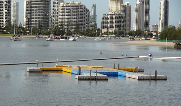
Continuing on with swimming areas, we've got a few on the GC that consist
of a floating boom suspending an underwater net, surrounding the designated
area. One of them then has a swimming raft in it:
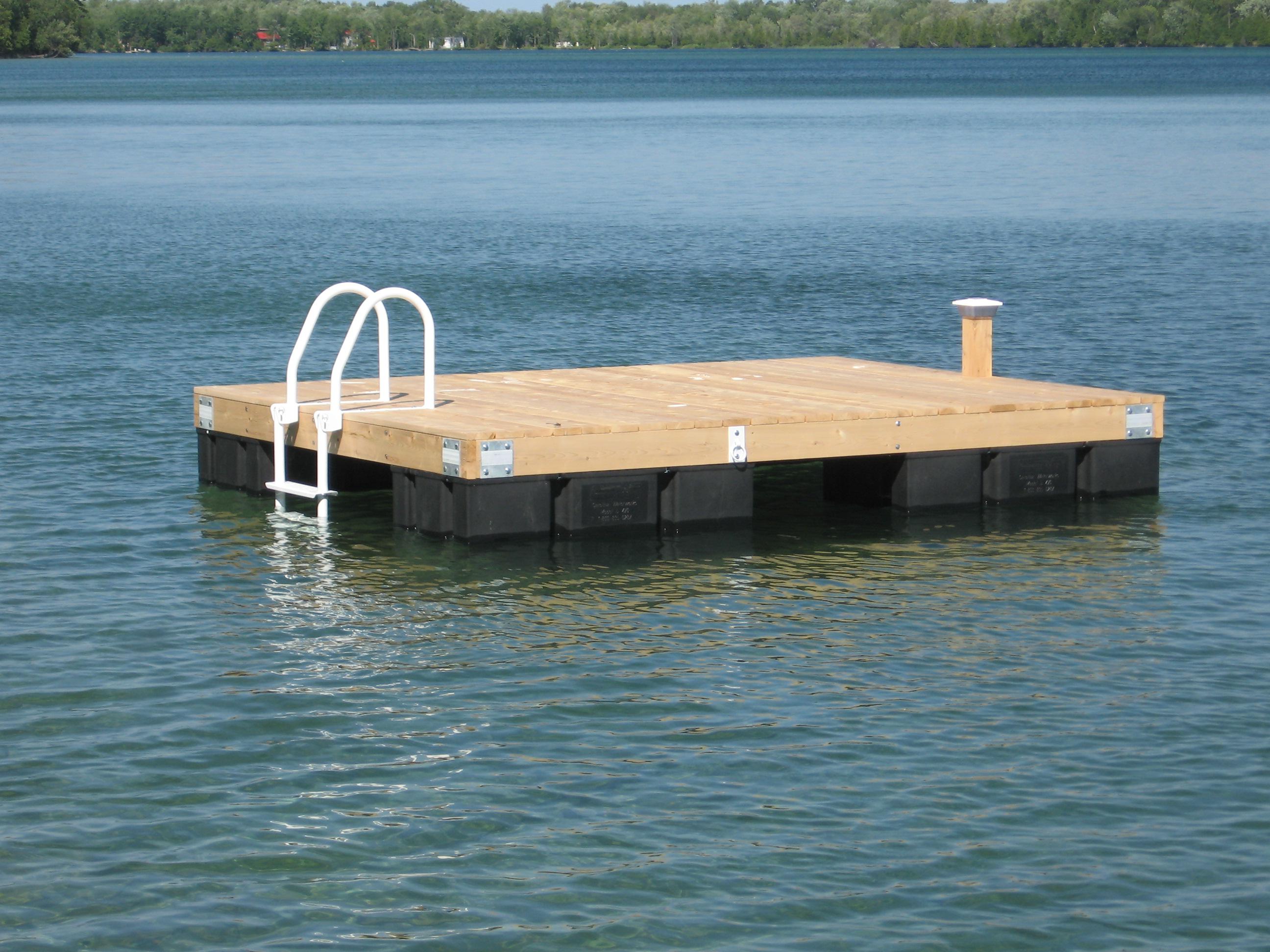
http://www.goldcoastkids.com.au/wp-content/uploads/2013/06/beaches-the-broadwater-blog-header.jpg

In OSM, the boom's are currently marked as fences:

http://www.openstreetmap.org/edit#map=18/-27.96790/153.41779, which doesn't
really seem right?

I can see reference in the wiki to an oil-boom, which is a floating boom to
contain oil spills, but not really appropriate.

Don't know if they'd be a pontoon either, because you can't really climb up
on it.

Any thoughts?

Graeme


Thanks

Graeme
_________________________________

Graeme Fitzpatrick

0407 754321

On 27 January 2017 at 06:23, Max Bainrot <mbain...@gmail.com> wrote:

> The swimming raft describes it exactly
>
> man_made=pontoon was my first thought but wasn't sure (was checking on a
> mobile device on the bus) so I'll use that.
>
> With tagging the ladder, the pontoons can rotate a fair bit so how
> sensitive is the position of something like a ladder?
>
> Swimming area is also something I plan on marking as these swimming areas
> do have buoys on like a cable around the perimeter marking the boundary.
>
> Thank you to everyone for their input so far, the help is very much
> appreciated.
>
>
> On 26 Jan. 2017 21:14, "Andrew Davidson" <thesw...@gmail.com> wrote:
>
> On 25/01/17 22:05, Andrew Harvey wrote:
>
>
>> As for the pontoon, per
>> https://wiki.openstreetmap.org/wiki/Tag:man_made%3Dpier "The
>> man_made=pier tag is used for a raised walkway over water supported by
>> pillars made of metal/wood, or floating and secured using chains",
>> plus floating=yes
>>
>>
> It would depend on whether we are talking about a floating jetty:
>
> http://www.letsonslanding.com/images/IMG_4212dock_wide.jpg
>
> or what our American friends would call a swimming raft:
>
> http://manitoulincedar.com/wp-content/uploads/2013/03/swim-raft-2013.jpg
>
> The first one is a pier but the second one isn't.
>
> It seems that there are two ways to tag a swimming raft. The first is from
> OpenSeaMap seamark:type=pontoon
>
> https://wiki.openstreetmap.org/wiki/Tag:seamark:type%3Dpontoon
>
> There's 36 of these. The other is man_made=pontoon (There's 87 of these).
>
>
> On 26/01/17 10:25, Graeme Fitzpatrick wrote:
> > Would you then mark the inside of the pontoon as a swimming pool?
> >
> > Could you mark a swimming pool in the middle of a lake?
> >
>
> Maybe swimming_area
>
> https://wiki.openstreetmap.org/wiki/Tag:leisure%3Dswimming_area ?
>
>
> _______________________________________________
> Talk-au mailing list
> Talk-au@openstreetmap.org
> https://lists.openstreetmap.org/listinfo/talk-au
>
>
>
> _______________________________________________
> Talk-au mailing list
> Talk-au@openstreetmap.org
> https://lists.openstreetmap.org/listinfo/talk-au
>
>
_______________________________________________
Talk-au mailing list
Talk-au@openstreetmap.org
https://lists.openstreetmap.org/listinfo/talk-au