 <blatant lie>Yeah, me too. I was just about to do that!
</blatant lie>
Fantastic!
----- Original Message -----
From: "Graham Jones"
To: TimSC
Cc: talk-gb@openstreetmap.org
Subject: Re: [Talk-GB] building shapes from OS Street View
Date: Fri, 9 Apr 2010 22:32:40 +0100
Hi Tim,That is exactly the sort of thing I had envisaged writing -
you have nearly finished before I got started - well done!
Graham.
On 9 April 2010 22:25, TimSC <mapp...@sheerman-chase.org.uk> wrote:
Hi again,
I have been working on auto tracing buildings and I'm making
progress. I
was slightly encouraged by Ed Avis's comments. I think one
underlying
difference is peoples attitude to omissions in map data. Many
people
think they are a good thing, particularly since they encourage
the
community to do high quality surveying. But I think omissions are
bad in
terms of actually using the map. I don't think we should be using
the
main map to gauge our progress. I suspect what we need is good
meta data
- how and when data is sourced. Anyway enough rambling...
Tracing buildings. I have been using the original images, since
image
transformations tend to introduce degradation of quality. I use
colour
to select building pixels, then form edge fragments, then form
polygons,
then simplify the polygons using the Douglas-Peucker algorithm,
then
group them so we get inner and outer edges, then tranform image
coordinates to GBOS then to WGS84 via OSTN02 (I ported the perl
code to
python), then save as OSM format and load back into JOSM.
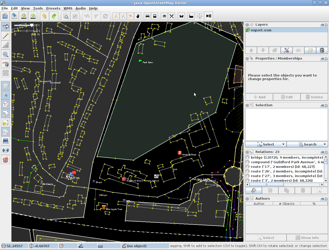
Screenshot:
http://timsc.dev.openstreetmap.org/dev/josm-building-outlines.png
The next steps are to improve the quality of the polygon shapes,
possibly by checking if the edges are nearly orthogonal, and if
so
making them completely orthogonal. Also I need to write a filter
to
check for buildings in the area, to avoid importing duplicate
buildings.
I need to look at the simplification, as sometimes an extra node
is
added to a polygon (the initial node used as the start of the
algorithm). I am also considering detecting roads that overlap
buildings
in the source images, since this is probably the biggest loss of
quality. The result I am getting is already more spatially
detailed than
my own survey of the University of Surrey campus (although not as
rich
in information).
In the medium term, I will import some buildings once I have the
quality
I want. I want to minimise manual work in JOSM but I don't rule
it out.
I will only be working in the Guildford area - it's my data to
gamble
around there :)
TimSC
_______________________________________________
Talk-GB mailing list
Talk-GB@openstreetmap.org
http://lists.openstreetmap.org/listinfo/talk-gb
--
Dr. Graham Jones
Hartlepool, UK
email: grahamjones...@gmail.com
_______________________________________________
Talk-GB mailing list
Talk-GB@openstreetmap.org
http://lists.openstreetmap.org/listinfo/talk-gb
--
_______________________________________________
Surf the Web in a faster, safer and easier way:
Download Opera 9 at http://www.opera.com
Powered by Outblaze
_______________________________________________
Talk-GB mailing list
Talk-GB@openstreetmap.org
http://lists.openstreetmap.org/listinfo/talk-gb