Hi all,

I am in the process of crowdsourcing geospatial data that may be of
interest to the OSM community
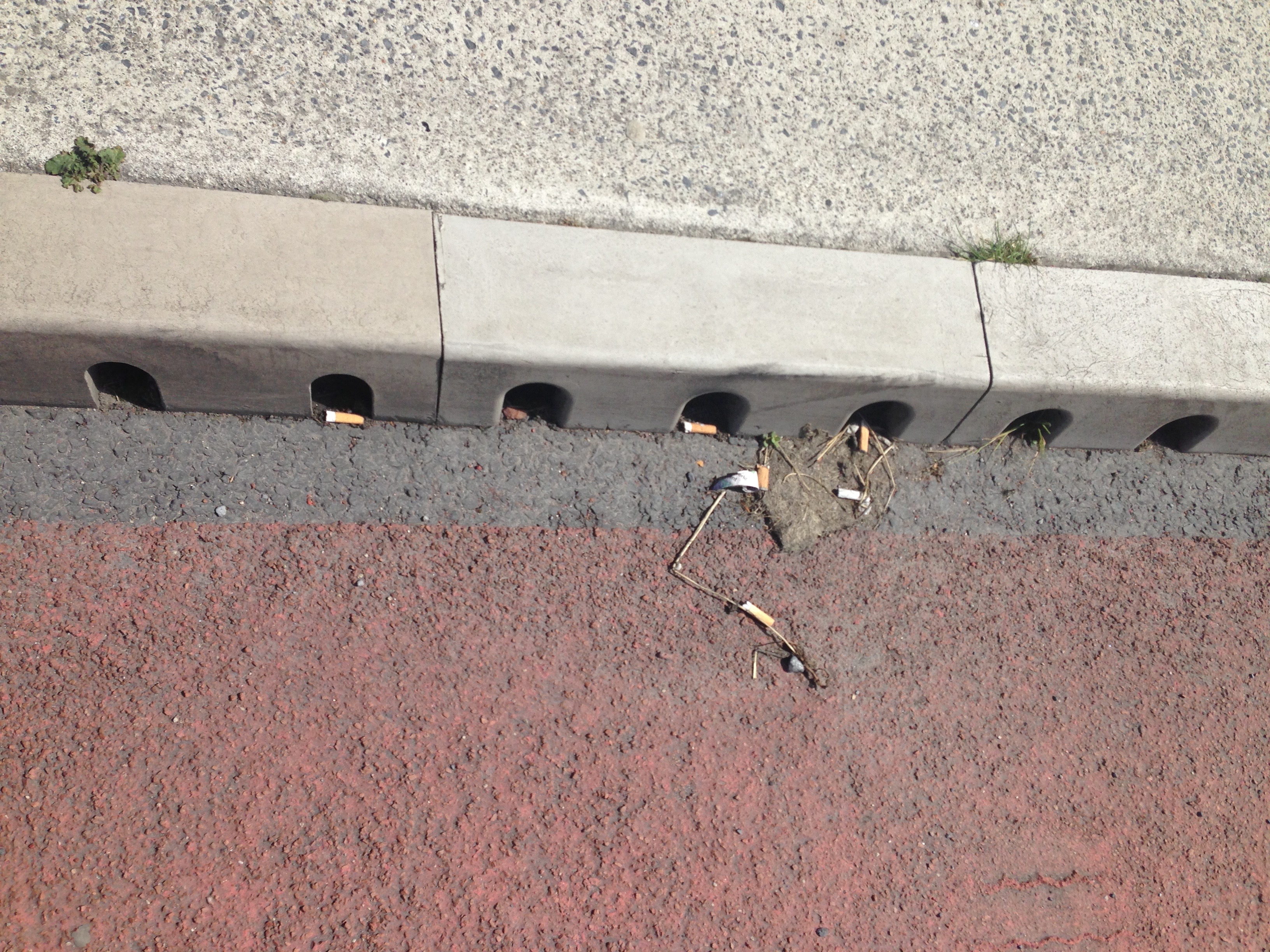
In particular, I am interested to know where are the pathways where litter
begins its journey to the ocean (eg gutters, storm drains etc).

If you are interested, following todays update, you can now log and collect
information on

- individual gutters
- long gutters
- small kerb holes and
- larger kerb holes

eg

https://www.instagram.com/p/BToLhAHjYI_/
<https://openlittermap.com/assets/cigbutts.jpg>
https://www.instagram.com/p/BTfC9-BjQxJ/
<https://openlittermap.com/assets/cigbutts.jpg>
https://openlittermap.com/assets/cigbutts.jpg

via OpenLitterMap.com which will be verified and made available to download
anywhere in the world

Feel free to add this in and consume the data via geotagged images which is
free to download by anyone

Kind regards,

Seán


--
https://openlittermap.com @OpenLitterMap (Fb, Tw, Ig)
M.Sc. Coastal & Marine Environments (NUIG, 2015)
M.Sc. GIS & Remote Sensing (UCC, 2014)
B.A. Geography & Economics (UCC, 2011)
ie.linkedin.com/in/seanlynchgis
_______________________________________________
Talk-ie mailing list
Talk-ie@openstreetmap.org
https://lists.openstreetmap.org/listinfo/talk-ie