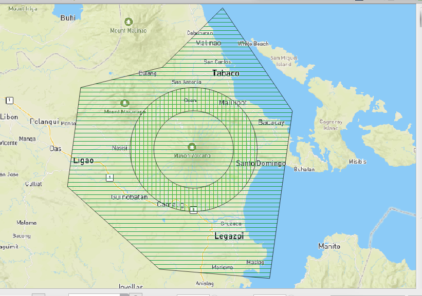
Ervin,

Thanks, this is so much bigger than the EDZ [0].  I feel its too much
too big AOI for mapping.
If we can have detailed poly that identifies at risk areas, that's much better.
[0]
https://user-images.githubusercontent.com/353700/35045993-ab1fce48-fbbb-11e7-9a98-51930ebc17c0.png

On Wed, Jan 17, 2018 at 6:52 PM, Ervin Malicdem <schad...@gmail.com> wrote:
> Here it is, Maning
>
> https://owncloud.cxsmedia.com/index.php/s/xI7M2yqVI0Zrrs0
>
> Ervin M.
> Schadow1 Expeditions - A Filipino must not be a stranger to his own
> motherland.
> http://www.s1expeditions.com
>
> On Wed, Jan 17, 2018 at 8:46 PM, maning sambale <emmanuel.samb...@gmail.com>
> wrote:
>>
>> Ervin,
>>
>> > A poly file [0] was created to prioritize its southwest quadrant where
>> > the
>> > magma initially flowed and also to include evacuation centers we mapped
>> > back
>> > during its phreatic eruption in 2014. I suggest we can also make this as
>> > the
>> > bounds for the HOT task.
>>
>> I can't find my poly to geojson coverter right now, can you share
>> geojson or shapefile?
>>
>> --
>> cheers,
>> maning
>> ------------------------------------------------------
>> "Freedom is still the most radical idea of all" -N.Branden
>> https://epsg4253.wordpress.com/
>> http://twitter.com/maningsambale
>> ------------------------------------------------------
>
>


--
cheers,
maning
------------------------------------------------------
"Freedom is still the most radical idea of all" -N.Branden
https://epsg4253.wordpress.com/
http://twitter.com/maningsambale
------------------------------------------------------

_______________________________________________
talk-ph mailing list
talk-ph@openstreetmap.org
https://lists.openstreetmap.org/listinfo/talk-ph