Hi folks, I'd like to add yet another 'flavour', maybe even some more
fuel to the discussion about the OSM license.
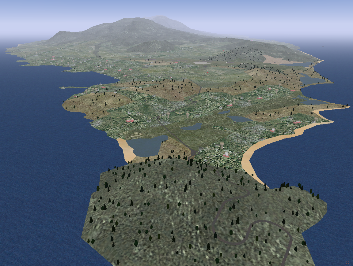
Some of you know about the flight simulation software FlightGear.
>From time to time, those who are involved in creating the FlightGear
World Scenery are getting asked why they don't use OpenStreetMap road
data for the Scenery. While there are some more winded reasons why this
didn't happen until now, the by far most obvious reason is the OSM
license, which, to our interpretation, puts us at the risk of a license
violation if we distribute our Scenery with OSM road data being used
for its build.
The FlightGear project has strong roots in the OpenSource tradition for
more than ten years now, therefore most questioners have "limited
appreciation" for license barriers within the OpenSource world.

Other reasons for not using OSM roads are somehow tied to the apparent
license issue and therefore are to be considered as being of secondary
importance.


I'd to give you a rough idea about the process that builds the
FlightGear Scenery. We have different sorts of vector data, mostly
polygon landuse data either from the venerable VMap0 database, which
covers the entire globe, automatically classified from Landsat7 images
or simply hand-drawn. And we have some sources of line data, like the
roads.
The whole run-time Scenery is organized as a large, irregular triangle
mesh. Thus, the roads which you see on the screenshot below, are also
an application of triangles, shaped in a way to display the lengthy
style of a broadened line. These triangles are covered by a predefined
texture.
Finally, there is no real line data anymore in the FlightGear Scenery,
just an arrangement of coloured triangles which look like a line in the
eye of the spectator.

As a side note: I know that we're not the first ones to implement OSM
roads into FlightGear Scenery. There is a use-case posted on the OSM
Wiki:


http://wiki.openstreetmap.org/index.php/Neat_Stuff#OSM_Data_in_a_Flight_Simulation


Now, in order to provide an object to discuss about and maybe also to
draw some public attention to the issue, we have prepared a nice chunk
of FlightGear Scenery around the island of St. Kitts (ICAO: TKPK):

  http://foxtrot.mgras.net/static/caribbean-OSM.tar.bz2

We also have a 'representative' screenshot - see the little, winded
grey lines:

  http://foxtrot.mgras.net/bitmap/FGFS/TKPK_03.png


Several people would be happy to see this sort of use getting
considered within future license discussions and maybe also in the
forming of a possibly revised OSM license. So, how are we supposed to
proceed wrt. use of OSM roads in a GPL-licensed project ?

Cheers,
        Martin.
--
 Unix _IS_ user friendly - it's just selective about who its friends are !
--------------------------------------------------------------------------

_______________________________________________
legal-talk mailing list
[EMAIL PROTECTED]
http://lists.openstreetmap.org/listinfo/legal-talk