Hi,
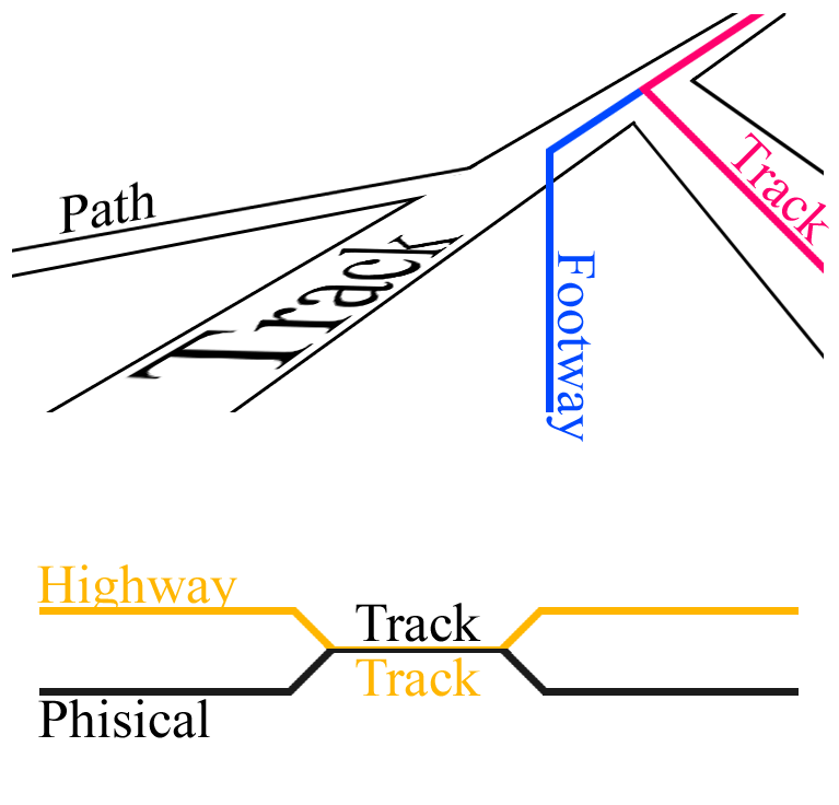
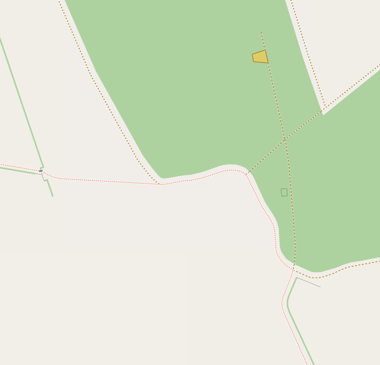
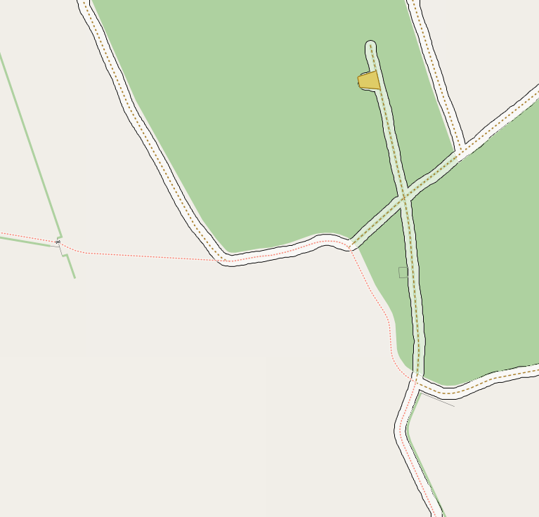
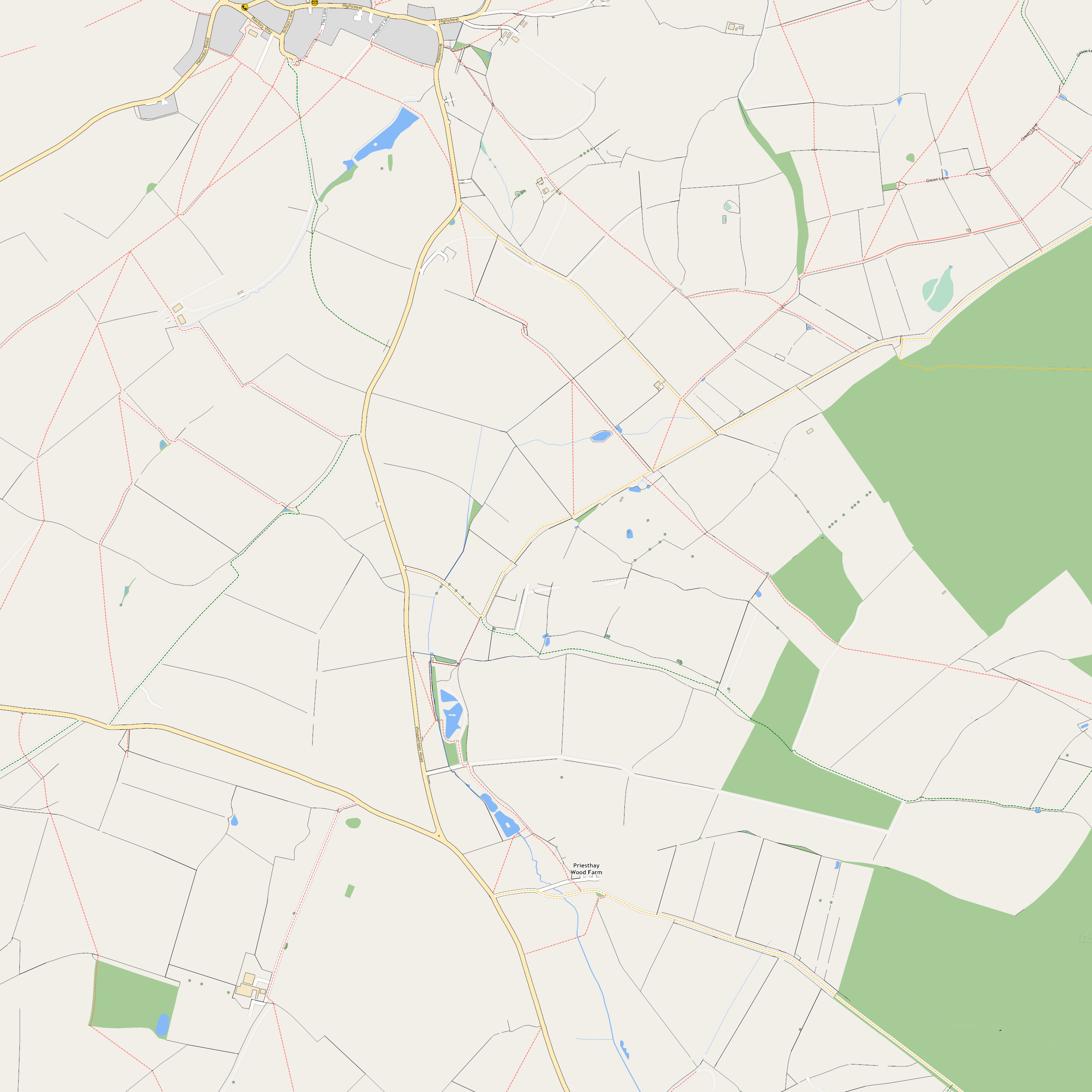
I don't usually partake in the mailing list, so it probably looks like I just
appear like I'm popping up and stirring trouble, but this is such a massive
problem for mapping in the UK rural areas, I've really just given up until some
way of making it possible is enabled, because it’s so disheartening not being
able to do things right, especially since the joy of mapping is in capturing
what you see around you.  I think this
would be 1 of my 3 wishes if a genie popped up right now, and I'm willing to
talk about this how ever long until something is sorted because it is stopping
good mapping full stop.  It's been a complete pain in the backside for half a
decade now; it's a joke.

The overall problem is OSM tags.
....Highway= in particular is a complete mess.
........Specifically there is the alternation OR merging of
physical/access/usage in the same field.
............1 particular tag where this is more of a problem than anything
else.  Highway=track.  It is stopping the most simple maps being made.

Highway=track.  Physical track, or access track?  Currently Osmarender seems to
have it physically represented, mapnik has it looking like access (based on
correlation of attributes)

Please check the image here:
http://i57.photobucket.com/albums/g226/ben_robbins_/Diagram1.png?t=1305927949

The top section has 'Physical' tracks and paths in black.  It has 'access'
rights in colours.   The diagram at the bottom then shows how OSM works, very
simplified.  Physical and Access are separated on most features, be it far more
messy than might be implied!, but for track they are merged.  This means that a
phisical track cannot exsist with a highway=bridleway.  It means that such a
simple and fundamental feature of a standard UK map is absolutely impossible in
OSM on the main page renders.

Very basically this is all a problem becuase highway=track and
highway=bridleway/byway/footway cannot both be tagged together.  They need to
be understood and moved, or duplicated into 'routes' or another key to state
access.   Having them together any longer will knock 10 years off my life, I'm
sure of it!  We need to either move bridleways/byways and footways to routes or
somewhere/anywhere else!, and just leave highway=track and highway=path.  Or we
need to move physical things (like tracks) out of the highway key, even though
highway is apparently 'Physical', realistically it primarily states access
rights.

Now the problem is beyond the archaic jumble of sporadically appearing highway
tags.  It's the renderers.  No matter what is said, they dictate everything
that happens.  People tag to render.  If it renders the tag is used.  If it
doesn't it's not used.  If it renders wrong, it's used, and that becomes right.
 I wish something could be done about this, but that's a future tangent.

The aforementioned track problem was solved by 'tracktype' which when put on a
way by itself states 'it is a track' 'it has surface x'  this means that
highway=byway could coexsist.  But no...the rendering rule sheets did not
follow, people tagged to render, and so it is now still as it was 5 years ago.

Please check the images here:

http://i57.photobucket.com/albums/g226/ben_robbins_/Example1.png?t=1305929249
http://i57.photobucket.com/albums/g226/ben_robbins_/Example2.png?t=1305929355
http://i57.photobucket.com/albums/g226/ben_robbins_/Example3.png?t=1305929355
http://i57.photobucket.com/albums/g226/ben_robbins_/Example4.png?t=1305929815

Here are a string of combinations, where I have quickly drawn (in a made up
style) physical tracks and paths, and access rights for tracks and footways
(assuming there's such a thing as track access outside the UK?).

Finally here I have an render
http://wiki.openstreetmap.org/w/images/4/40/South_Wappenham.png
This is all done with out a single tag change, I have just used 'track type' as
originally proposed, and described above.  The difference is that I have
changed the render rules accordingly.

Please can we:

1) discuss highway=track and/or moving highway=bridleway/byway etc so that they
can coexist
2) please update render rules.
3) After the first 2 take a long serious look at the highway= tag in general.
I would elaborate, but this is long enough already.

As a finally round up, I would just say, I don't care if I'm tagging
elephant=cookie; yes=no.  All I want is the liberation of being able to have a
footway on a track in the renders.  Any suggestions welcome, any method,
anything.  I'm now going to go up mountains for 3 days where tracks and
bridleways can be tackled together! Apologies on delay therefore.  I will be
back!

Toodly pip,
Ben
_______________________________________________
talk mailing list
[email protected]
http://lists.openstreetmap.org/listinfo/talk