That the USGS is not claiming copyright is clear. My issue is that the maps themselves are obviously based on sources that were not produced by the USGS themselves (maps probably confiscated or otherwise obtained during WWII). The first one I looked at referenced an Hungarian map from 1940 (which potentially could be out of copyright but just as good could not be) just as an example.
Simon

Am 15.01.2012 23:54, schrieb Janko Mihelić:
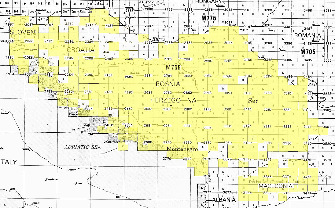
There is a statement here:
http://www.lib.utexas.edu/maps/faq.html#3.html

And there is no special marking of copyright on those maps.

Janko

2012/1/15 Simon Poole <si...@poole.ch <mailto:si...@poole.ch>>

    These maps seem to be derived from non-US sources (maps)  that may
    actually still be copyrighted. Has there been any formal and
    official statements on the status?

    Simon

    Am 15.01.2012 23:26, schrieb hbogner:

        He forgot the translation :D

        New imagery

        Hi from croatia mappers!
        The U.S. Geological Survey has made public maps of the whole
        Ex Yugoslavia under the Public Domain license, which means we
        can use them in the Openstreetmap project. List of maps in pdf
        format here:
        https://www.lib.utexas.edu/maps/topo/former_yugoslavia/

        Unfortunately, not all maps are scanned, the yellow areas are
        available:
        http://www.lib.utexas.edu/maps/topo/former_yugoslavia/index_map.jpg

        Our member dodobas geocoded the maps and we put them on the
        server maintained by user hbogner on the Faculty of Geodesy in
        Zagreb.
        We are inviting you to use the imagery to fill the
        Openstreetmap with as much usefull data possible!

        I suggest you use the tag source=U.S. Defense Mapping Agency
        for the elements drawn over these backgrounds so we can easily
        find what is drawn with these maps.
        How to use them?

        In JOSM:
        Go to Edit > Preferences... > WMS TMS > + (Plus sign lower
        right) > TMS
        Menu name= USGS osm-hr
        TMS URL =
        http://tms.osm-hr.org/1.0.0/all_ustopo/{zoom}/{x}/{y}.png
        <http://tms.osm-hr.org/1.0.0/all_ustopo/%7Bzoom%7D/%7Bx%7D/%7By%7D.png>
        Screenshot: http://osm-hr.org/josm.png

        In Potlatch:
        Go to Background > Edit...
        Make a new line:
        Name= USGS osm-hr
        URL= http://tms.osm-hr.org/1.0.0/all_ustopo/$z/$x/$y.png
        Screenshot: http://osm-hr.org/potlach.jpg

        If there are any problems, contact us!
        http://osm-hr.org/


        _______________________________________________
        talk mailing list
        talk@openstreetmap.org <mailto:talk@openstreetmap.org>
        http://lists.openstreetmap.org/listinfo/talk


    _______________________________________________
    talk mailing list
    talk@openstreetmap.org <mailto:talk@openstreetmap.org>
    http://lists.openstreetmap.org/listinfo/talk
_______________________________________________
talk mailing list
talk@openstreetmap.org
http://lists.openstreetmap.org/listinfo/talk