Sorry, I meant bottom *right* hand corners. South East, I guess.

/ICanDoesMaps
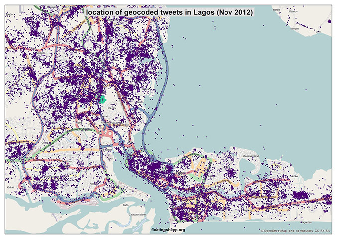
On 15 February 2013 14:05, Joseph Reeves <iknowjos...@gmail.com> wrote:

> Hi Pavithran,
>
> Looking at the images, I can see attribution in the bottom left corners.
> It's a little small, but it's there:
> http://static.guim.co.uk/sys-images/Guardian/Pix/pictures/2013/2/14/1360836990090/Lagos-007.jpg
>
> Presumably these were scaled to fit the Guardian site and were originally
> more readable.
>
> Cheers, Joseph
>
>
> On 15 February 2013 13:58, pavithran <pavithra...@gmail.com> wrote:
>
>> Hi ,
>> Anyone glancing at the image published by The Guardian data [1] could
>> say its a OpenStreet Map . But there was no mention of that .
>> I went forward and read the article in Floating sheep [2] which also
>> doesn't mention anything about the maps being based / are OpenStreet
>> Map . Ironic is the fact that the author has taken pain to give
>> citations/ references to Geographical Research papers but missed even
>> a lil bit of info on where the maps are from .
>>
>> Sad to say that its coming from a research institute which studies the
>> "web" on issues like privacy ,copyright etc .
>>
>> 1.
>> http://www.guardian.co.uk/news/datablog/gallery/2013/feb/14/africa-tweets-mapped
>> 2 .
>> http://www.floatingsheep.org/2013/02/the-urban-geographies-of-tweets-in.html
>>
>> PS : I do realise that it[2] isnt an institute blog/press .
>>
>> Regards,
>> Pavithran
>>
>>
>> --
>> pavithran sakamuri
>> http://look-pavi.blogspot.com
>>
>> _______________________________________________
>> talk mailing list
>> talk@openstreetmap.org
>> http://lists.openstreetmap.org/listinfo/talk
>>
>
>
_______________________________________________
talk mailing list
talk@openstreetmap.org
http://lists.openstreetmap.org/listinfo/talk