texascavers Digest 6 Oct 2010 06:17:59 -0000 Issue 1162

Topics (messages 16222 through 16231):
Re: La Joya de Salas
        16222 by: Mark Minton
        16223 by: David
        16225 by: John Brooks

Re: Longhorn Caverns Wild Cave Tour During TCR
        16224 by: Mark.Alman.L-3com.com

Joya de Salas
        16226 by: Mixon Bill
        16229 by: Mark Minton
        16230 by: James McLane

UT Grotto Meeting - Wednesday October 6
        16227 by: Gary Franklin

Agenda for TSA Fall Business Meeting at TCR, Sunday, October 17th at 9 AM
        16228 by: Mark.Alman.L-3com.com

an interesting trip report
        16231 by: David

Administrivia:

To subscribe to the digest, e-mail:
        <texascavers-digest-subscr...@texascavers.com>

To unsubscribe from the digest, e-mail:
        <texascavers-digest-unsubscr...@texascavers.com>

To post to the list, e-mail:
        <texascavers@texascavers.com>


----------------------------------------------------------------------
--- Begin Message ---
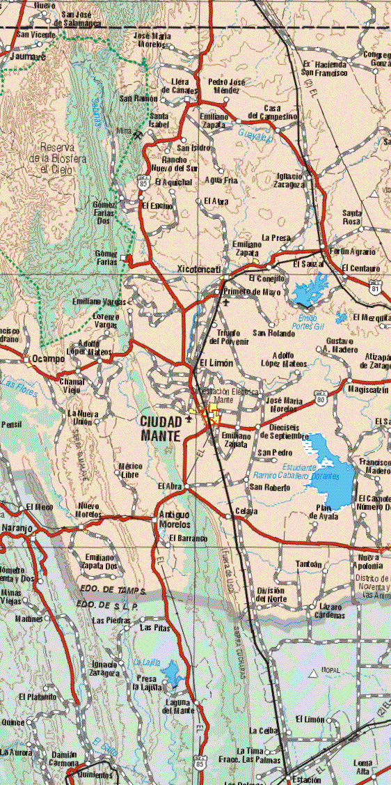
        David Locklear said

>The coordinates below are to the entrance to La Joya de Salas:
>+23° 12' 2.18", -99° 17' 8.67" (23.200606, -99.285743)
I think that location for Joya de Salas
is incorrect. The Google Earth image shows large
fields just to the south, and I do not think that
is possible for "our" Joya de Salas. The
satellite image is too low resolution to see much
detail on the ground, so I can't say where I
think Salas actually is. I do not have the topo
map, but my guess is that it is south of the
given location, possibly in the area of
clouds. If anyone has the topo and could provide
lat/lon or UTM coordinates, that would certainly help.
>The coordinates below appear to be a large sinkhole in a remote
area near the cave known as Joya de Salas.
>23.189797,-99.2698
We did explore a large open-air pit on
the way up to Joya de Salas back in 1979. It was
Joya de la Mina Barita, but I don't think this is
it. However we were told of a pit larger than
Salas located about 9 km to the northwest, so
this could be that pit. We did not have time to
go there and I don't know that anyone ever went
back to look for it. See AMCS Activities Newsletter 11, p 61-63, 1980.
Mark Minton

Please reply to mmin...@caver.net
Permanent email address is mmin...@illinoisalumni.org
--- End Message ---
--- Begin Message ---
I think Mr. Mintion is correct that the label Joya de Salas is
not correct on the map link I posted.

After looking at it closer and trying hard to dig it out of my
fuzzy memory,  the coordinates below sound more likely
for the pit:

       23.182125,-99.303929

The houses located just south of the fields is the community
of Joya de Salas, and the big entrance drop is within a short
walk of there and out in the open as shown in the video link
I posted.

Here are some possible photos of the area:

       http://www.ajeepear.com/foros/index.php?showtopic=15572

The map below gives one an idea as to the remoteness of the
cave.     But the cave's waiting to be discovered are up in the
hills and will require machete's and long hikes to reach them.

      http://es.wikiloc.com/wikiloc/view.do?id=127982

We drove up there from the small roadside town of El Encino,
by crossing the Rio Sabinas and then immediately making
a left turn up into the El Cielo Preserve.    I don't
see anything on the aerial photo to show that, but it is on the
link below:


http://www.maps-of-mexico.com/tamaulipas-state-mexico/tamaulipas-state-mexico-map-b3.gif

left click your mouse to zoom in on the Gomez Farias area.

Several major storms have hit that area in the past 10 years, so maybe that is
enough reason to re-check some leads up there.

David Locklear
--- End Message ---
--- Begin Message ---
That sounds like an area that the Aggies visited with Bill Elliott in the late
70s. Over a couple of trips, past El Cielo Preserve, we surveyed several caves
and found a few pits. There was a report in the AMCS newsletter at the
time....on one trip....vehicle problems left us stranded in the mountains for
several days. We put the time to good use exploring nearby pits along the road
several clicks past El Cielo.

Sent from my iPhone

On Oct 4, 2010, at 1:54 PM, David <dlocklea...@gmail.com> wrote:

I think Mr. Mintion is correct that the label Joya de Salas is
not correct on the map link I posted.

After looking at it closer and trying hard to dig it out of my
fuzzy memory,  the coordinates below sound more likely
for the pit:

      23.182125,-99.303929

The houses located just south of the fields is the community
of Joya de Salas, and the big entrance drop is within a short
walk of there and out in the open as shown in the video link
I posted.

Here are some possible photos of the area:

      http://www.ajeepear.com/foros/index.php?showtopic=15572

The map below gives one an idea as to the remoteness of the
cave.     But the cave's waiting to be discovered are up in the
hills and will require machete's and long hikes to reach them.

     http://es.wikiloc.com/wikiloc/view.do?id=127982

We drove up there from the small roadside town of El Encino,
by crossing the Rio Sabinas and then immediately making
a left turn up into the El Cielo Preserve.    I don't
see anything on the aerial photo to show that, but it is on the
link below:


http://www.maps-of-mexico.com/tamaulipas-state-mexico/tamaulipas-state-mexico-map-b3.gif

left click your mouse to zoom in on the Gomez Farias area.

Several major storms have hit that area in the past 10 years, so maybe that is
enough reason to re-check some leads up there.

David Locklear

---------------------------------------------------------------------
Visit our website: http://texascavers.com
To unsubscribe, e-mail: texascavers-unsubscr...@texascavers.com
For additional commands, e-mail: texascavers-h...@texascavers.com
--- End Message ---
--- Begin Message ---
All,


TCR is less than two weeks away!

Can you believe it?!


Since TCR wil be held near the Marble Falls/Burnet area this year, I contacted
Longhorn Caverns State Park about some kind of group rate for their wild cave
tour (and, maybe, other parts of the cave some of you may know about and have
toured and/or worked in).

They gave me a price of $35 per person.

I am still signing folks up, so if this sounds like something you'd like to do,
give me a shout!

I was there last weekend and the cave is nice and wet and muddy, so, it should
be a fun time!


Thanks!

Mark


P.S. - Be on the lookout for a MAJOR project announcement concerning a
multitude of tasks at this great and historic cave and friendly and
accomodating State Park. A project that should keep cavers busy for a few years
to come!
--- End Message ---
--- Begin Message ---
I'll take this opportunity to point out that there's a historical
article, based on Orion Knox's personal trip logs, on the original
visits to Sótano de la Joya de Salas in 1965 in AMCS Activities
Newsletter 32, pages 133-145, 2009. The article includes the early map
of the cave, photos of the original exploration, and the 1972 more
detailed foldout map from the Canadian Caver magazine. Yours for a
mere $14 at TCR. -- Bill Mixon, AMCS editor
----------------------------------------
A chicken is the egg's way of making another egg.
----------------------------------------
You may "reply" to the address this message
came from, but for long-term use, save:
Personal: bmi...@alumni.uchicago.edu
AMCS: edi...@amcs-pubs.org or sa...@amcs-pubs.org
--- End Message ---
--- Begin Message ---
The historical route to Joya de Salas
was a long 4WD road from El Encino on the
Inter-American Highway (Mex 85) south of Cd
Victoria. There is now a shorter road from
Jaumave, southwest of Victoria on Mex 101. It
would be an interesting trip to drive all the way
across the Sierra de Guatemala looking for
caves.
<http://www.janambre.com.mx/Turistam/?p=134>
(The description of Sótano de Joya de Salas there is rather overblown...)
Mark Minton

At 07:11 PM 10/4/2010, Mixon Bill wrote:
I'll take this opportunity to point out that there's a historical
article, based on Orion Knox's personal trip logs, on the original
visits to Sótano de la Joya de Salas in 1965 in AMCS Activities
Newsletter 32, pages 133-145, 2009. The article includes the early map
of the cave, photos of the original exploration, and the 1972 more
detailed foldout map from the Canadian Caver magazine. Yours for a
mere $14 at TCR. -- Bill Mixon, AMCS editor
Please reply to mmin...@caver.net
Permanent email address is mmin...@illinoisalumni.org
--- End Message ---
--- Begin Message ---
In November 1970 I went to Mexico with Houaston caver Billy Campbell and his
family.  We wanted to see the Sierra Guatamela and the  Rancho Cielo nature
preserve. We towed motorcycles down on a trailer and camped near the river at
Encino. The weather was great.  Trying to ascend the steep lumber road to Llera
was too difficult for Billy's wife Suzy riding her bike.  Billy and son Scott
were riding double on his cycle. We had to return to the campsite.  The next
day Billy and I did the trip alone leaving Suzy and Scott at camp. At Llera we
stopped in a tiny tienda for a coke.  I remember a chicken picking seeds off my
pant legs while I sat at a table.  The road south on the top of the mountain is
flat and runs through very tall trees.  It was a cloudless day, but the trees
were so dense it was hard to get enough light to take good photographs.  We
eventually came upon Rancho Cielo.  This biological research station was
formally owned by a man (I think his name was Harrison) who was murdered by
folks from a nearby ejido.  It was being operated by Texas Southmost College as
an environmental research station.  There was a woman running around with a
butterfly net.  She wasn’t friendly so we left.  From Rancho Cielo the road
down the mountain to Gomes Farias was the steepest descent I have ever
experienced.  At the bottom, the front shock absorbers on my cycle were hot!
Back on the pavement, my much-modified Honda trail 90 siezed a piston and Billy
had to tow me on the Pan American highway from Gomez Farias all the way back to
Encino with a rope on my handlebars.  I later found that the Honda ‘s oil
pickup screen was clooged and that it why it had chronic problems with
lubrication.
- Jim McLane in Houston


> Date: Tue, 5 Oct 2010 10:05:28 -0400
> To: texascavers@texascavers.com
> From: mmin...@caver.net
> Subject: [Texascavers] Re: Joya de Salas
>
> The historical route to Joya de Salas
> was a long 4WD road from El Encino on the
> Inter-American Highway (Mex 85) south of Cd
> Victoria. There is now a shorter road from
> Jaumave, southwest of Victoria on Mex 101. It
> would be an interesting trip to drive all the way
> across the Sierra de Guatemala looking for
> caves.
> <http://www.janambre.com.mx/Turistam/?p=134>
> (The description of Sótano de Joya de Salas there is rather overblown...)
>
> Mark Minton
>
> At 07:11 PM 10/4/2010, Mixon Bill wrote:
> >I'll take this opportunity to point out that there's a historical
> >article, based on Orion Knox's personal trip logs, on the original
> >visits to Sótano de la Joya de Salas in 1965 in AMCS Activities
> >Newsletter 32, pages 133-145, 2009. The article includes the early map
> >of the cave, photos of the original exploration, and the 1972 more
> >detailed foldout map from the Canadian Caver magazine. Yours for a
> >mere $14 at TCR. -- Bill Mixon, AMCS editor
>
> Please reply to mmin...@caver.net
> Permanent email address is mmin...@illinoisalumni.org
>
>
> ---------------------------------------------------------------------
> Visit our website: http://texascavers.com
> To unsubscribe, e-mail: texascavers-unsubscr...@texascavers.com
> For additional commands, e-mail: texascavers-h...@texascavers.com
>
--- End Message ---
--- Begin Message ---
Underground Texas Grotto meeting October 6, 2010


The meeting is on Wednesday from 7:45 P.M. - 9:00 P.M.

University of Texas Campus in 3.02 Painter Hall

NOTE:  THE ROOM NUMBER CHANGE to 3.02 PAI

http://www.utexas.edu/maps/main/buildings/pai.html


Sean Lewis will present "Exploration in the Fisher Ridge Cave System"  Sean
has visited this extensive cave system in Kentucky many times.  Come check
his ongoing adventure to this system.


For information on Underground Texas Grotto activities, please see
www.utgrotto.org    All of our information including officer contact info,
trips reports, new caver training, event calendar, and posting links to
beginner trips or vertical rope training are available.


Before the meetings, some may go to Sao Paulo  www.saopaulos.net  for happy
hour specials.  After the official meeting, we continue the tradition to
reconvene for burgers, beer, and tall tales of caving at Posse East.
www.posse-east.com


The UT Grotto needs you, the caver with photos and a story to share about
your adventures, scientific research, or something else really cool.  Contact
Gary v...@utgrotto.org
--- End Message ---
--- Begin Message ---
Here's the preliminary agenda for the TSA Business meeting to be held,
somewhere, at TCR, Sunday, 10/17 at 9AM.


Feel free to email me you comments, suggestions, and anything else you
would like to discuss.


Thanks!


Mark


2010 Fall Business Meeting


Texas Speleological Association


Agenda


*       Welcome and Introductions


*       Chairman's Report


*       Vice Chairman's Report


*       Secretary's Report


        *       Minutes of TSA Spring Business Meeting at TSA Convention
in Cedar Park.


*       Treasurers Report


*         TSA Projects - Jim Kennedy

                *       Current Projects - Gov't Canyon (Marvin Miller),
Colorado Bend State Park (Crash)
                *       Longhorn Cavern Project - Mark Alman
                *       New Projects - Hill Country State Natural Area &
Devils River (Rob Bissett), Eisenhower Ranch (Terry Holsinger), Camp
Wood Ranch (led by Arron Wertheim), Lake Amisted Project (TSS project
led by Jerry Atkinson).
                *       Future Project Ideas


*       Standing Committee Reports


        *       TSA Website - Butch Fralia
        *       Membership Chair - TBA
        *       Conservation Committee - Lyndon Tiu and Jim Kennedy (WNS
Update)
        *       Safety and Techniques - David Ochel
        *       Publications - Mark Alman

                *       The TEXAS CAVER and online access to back
issues.

        *       TSA Store - Lee Jay Graves


*       Old Business

        *       TSA/TSS Trailer Status - Jim Kennedy and Rob Bissett
        *       Open up the TEXAS CAVER to free access, after one year
of publish date. - Status

*       New Business

        *       TSA Spring Convention - April 1st-3rd, 2011, Fort Clark
Springs, Brackettville, TX
        *       Election Report - Ron Ralph
        *       New TSA Bat Stickers and Die - Don Arburn
        *       Anything else?


*       Announcements?


        *


*       End of Meeting (Let's go home!)
--- End Message ---
--- Begin Message ---
Here is an interesting trip report for Blue Spring Resurgence in
Tennessee from about 8
days ago.


http://www.cavediver.net/forum/showthread.php/14520-Blue-Spring-Resurgence-TN

It appears there will be an even more exciting trip report to be
posted very soon, as the
divers apparently returned 2 days ago, and made a major connection.
--- End Message ---