Hi mappers!

I've an idea for a new Therion-feature.
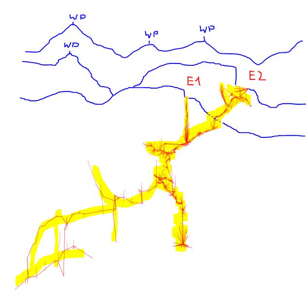
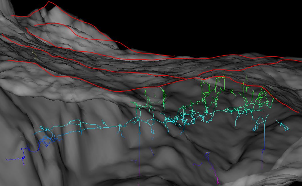
The feature affects only the elevation view, in a stated view direction.

The target is, to get a map with a elevation projection and a reference to
the surface.


If a surface is integrated in the project, it could be used to generate
automatically a surface-panorama from the surface point-cloud, on the basis
of the elevation-view-direction. And this could be printed to the elevation
map.

(like http://www.viewfinderpanoramas.org/panoramas.html)


With an layout option should it be controlled: e.g.:

elevation-panorama on|grid|off


off:

no surface panorama (default)


on:

One panorama piece, calculated from view direction and the middled object
extension.

Or serval panorama pieces, one per entrance reference or/and the panorama
was calculated by topographic prominence in the integrated surface.

(http://en.wikipedia.org/wiki/Topographic_prominence)


grid:

serval panoramas (each calculated on the grid value, opaque on top of each
other)


Optional:

With a waypointlist in the surface block could be peak's or other interessts
marked.

Or with a new fixed station flag, e.g. "peak".


This would be a nice feature.

Is this possible? Or absolutely utopistic?


//dirk

-------------- next part --------------
An HTML attachment was scrubbed...
URL:
<http://mailman.speleo.sk/pipermail/therion/attachments/20150514/e1b173e7/attachment.html>
-------------- next part --------------
A non-text attachment was scrubbed...
Name: panorama.jpg
Type: image/jpeg
Size: 42279 bytes
Desc: not available
URL:
<http://mailman.speleo.sk/pipermail/therion/attachments/20150514/e1b173e7/attachment.jpg>
-------------- next part --------------
A non-text attachment was scrubbed...
Name: idea.jpg
Type: image/jpeg
Size: 91014 bytes
Desc: not available
URL:
<http://mailman.speleo.sk/pipermail/therion/attachments/20150514/e1b173e7/attachment-0001.jpg>