2015-11-29 22:05 GMT+01:00 Simon Poole <si...@poole.ch>:

> I would rather be looking for something that fits in with SIT (
> http://wiki.openstreetmap.org/wiki/Simple_Indoor_Tagging) better.
>
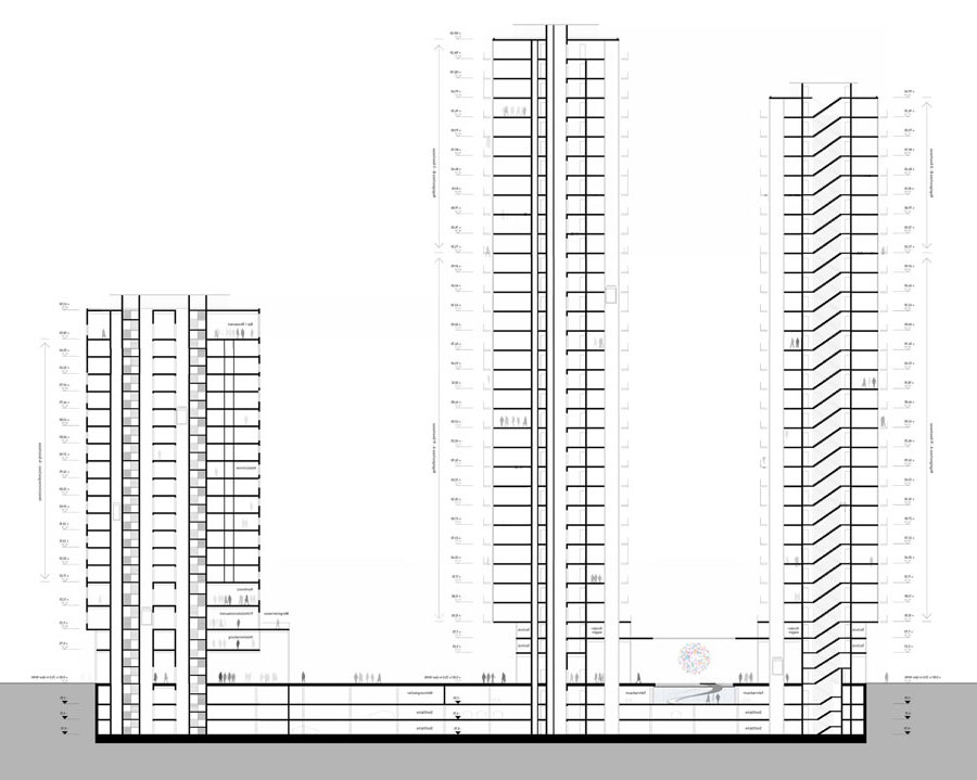
I don't see why this doesn't integrate. E.g. your example
shop=supermarket
level=0

could have the tags added:
level:ref=EG
level:name=Erdgeschoss

This might look unneccessary at first glance (and in many cases it is), but
there are cases with particular floor numbering and naming schemes where it
is helpful.


> Since SIT works really well (see OpenLevelUp),
>


The min_level-idea doesn't work AFAIK in all cases, where storey heights of
adjacent buildings are different and they are connected by a bridge, and
more general, it doesn't work where levels aren't simply stacked and
uniform for the whole part/buidling but are inclined or have varying
absolute elevations in different rooms (e.g. connected by a ramp). The
min_level of which building should apply? I still suggest to use
building_levels for the amount of all levels of that building part /
building, not the concept of "building_levels=min_level of a neighbouring
building until first level+amount of building levels of the part that is
tagged".

Also buildings with varying floor heights are not depictable (AFAIK).

Some examples:
http://www.fk3.tu-braunschweig.de/blog/wp-content/uploads/2011/07/CloudClub-AWARD-2011_Anna-Katharina-Mielck_Schnitt.jpg
http://apb2013.de/publikumspreis/controller/thumbnailer/?query=Projekte/unkategorisiert/13/files/ze511_zanderroth_Schnitt_2.jpg&height=250&width=354
https://www.akbw.de/uploads/tx_templavoila/pt_19029_Zach_SchnittB.jpg
http://cdn2.world-architects.com/img/frontend/pages/1893/900:w/podest-berlin-schnitt.jpg
http://www.rundzwei.de/sites/default/files/styles/1120x640/public/projects/rd2_pr_web_026_02_schnitt_0.jpg?itok=jK9sgBAY

Cheers,
Martin
_______________________________________________
Tagging mailing list
Tagging@openstreetmap.org
https://lists.openstreetmap.org/listinfo/tagging