Am Fr., 3. Mai 2019 um 17:20 Uhr schrieb Tobias Knerr <o...@tobias-knerr.de>:
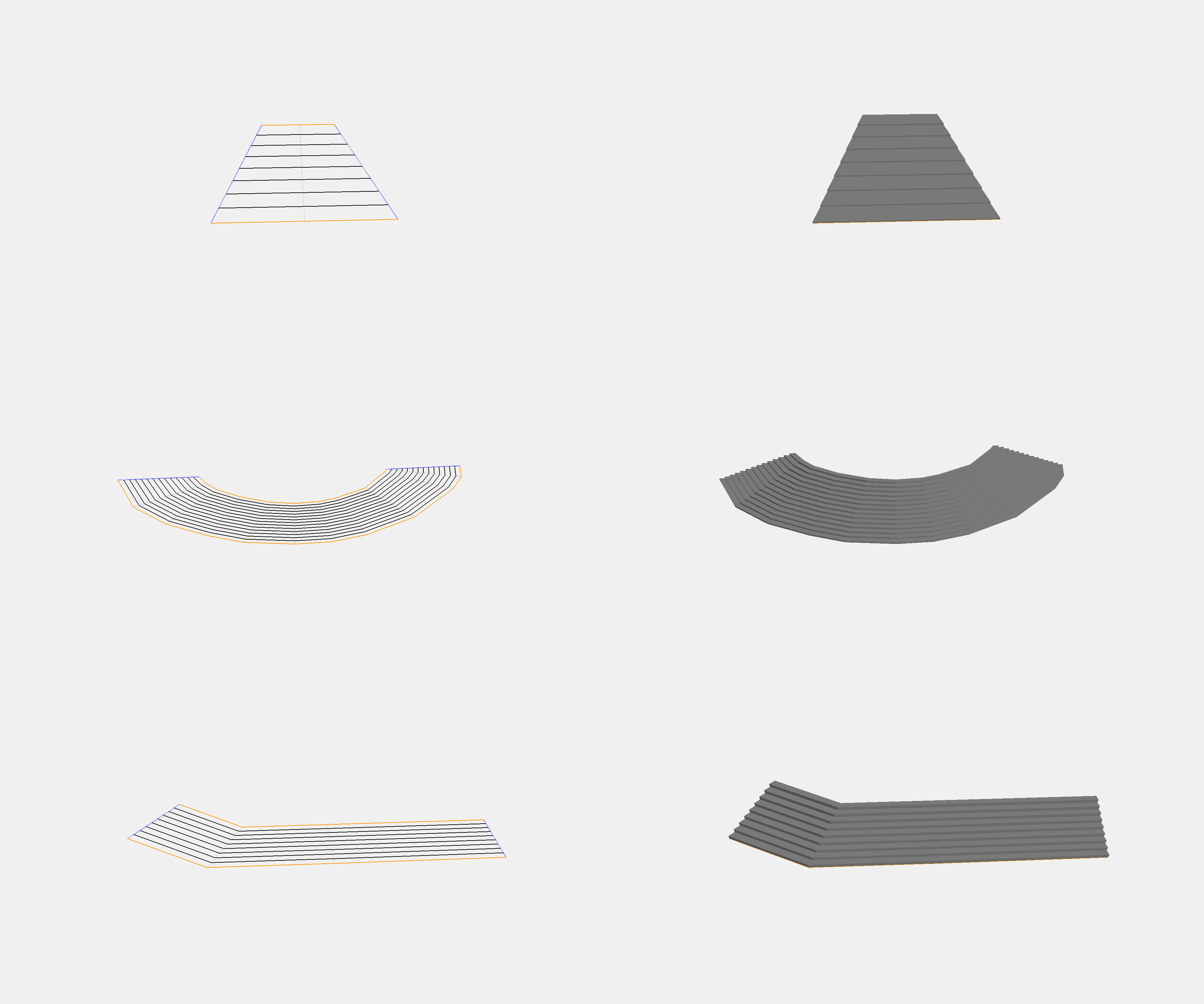
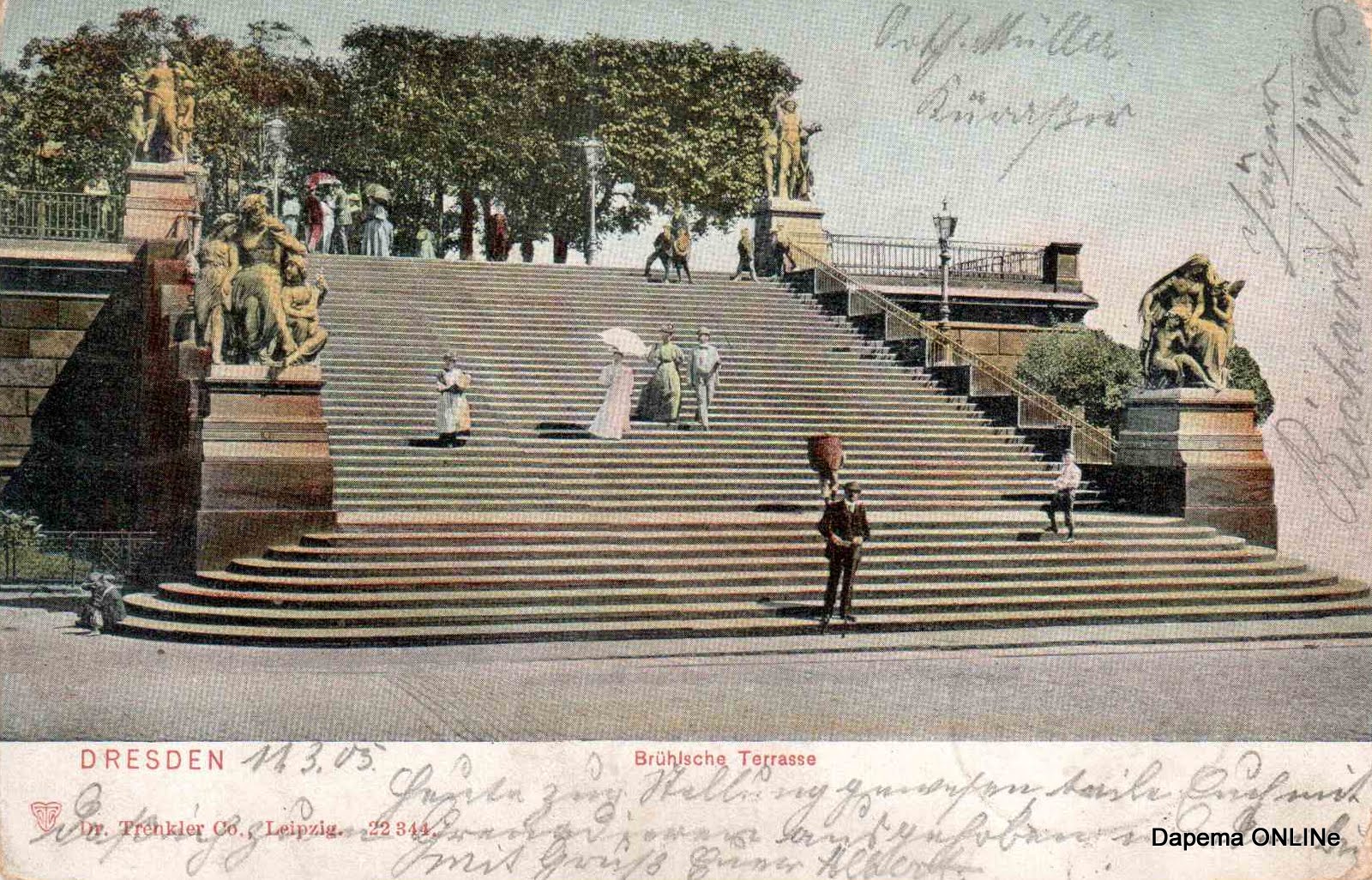
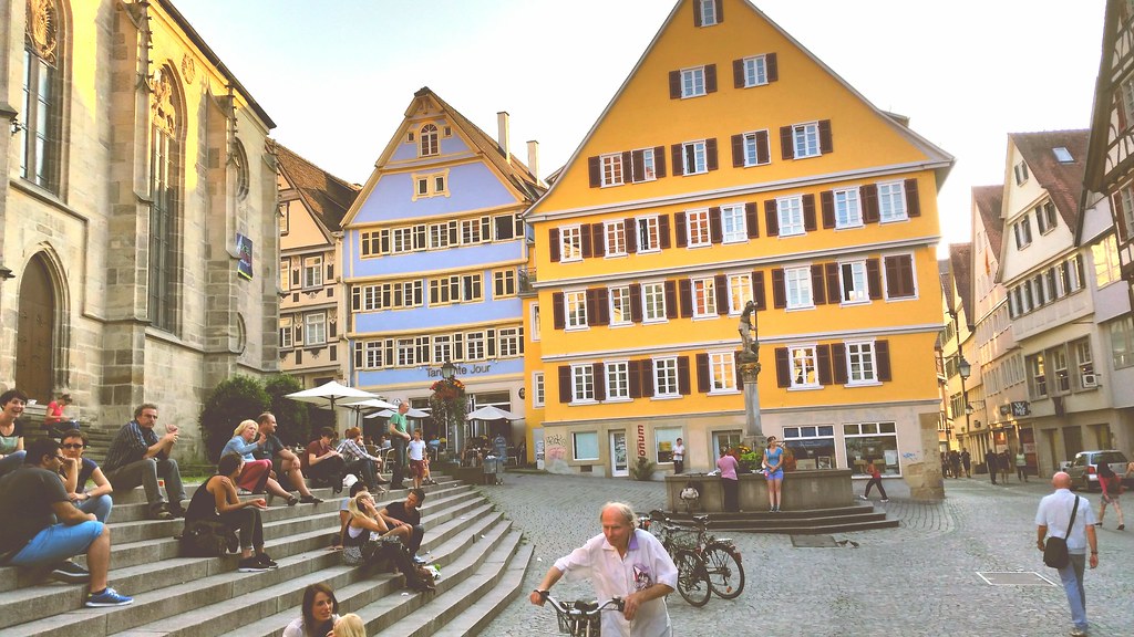
> On 11.04.19 23:28, Tobias Knerr wrote:
> So I finally got around to building that prototype to test my idea. The
> code only needs a highway=step way and an area:highway polygon as input,
> and produces sensible results for common shapes of straight stairways.
> I'm pretty happy with the results:
>
> http://tobias-knerr.de/upload/Step%20Polygon%203D%20Examples.png
>


this is really great, seems you solved it

Can it cope with cases like these?
http://1.bp.blogspot.com/--QaPv-T1b2Q/TWEia7iPWYI/AAAAAAAAEwQ/dtB1TfiqeA0/s1600/Dresden_Treppe_BrTerrasse_1905.jpg
(Dresden, Brühlsche Terrassen)

Or similarly these
https://t-ec.bstatic.com/images/hotel/max1024x768/504/50497971.jpg

The problem is that it may not be clear to the software whether the steps
run around the corner or are straight.
It may work to split this into several areas though.


This one shows a common problem, occurring when the surroundings are not
completely leveled (steps that do not run across the whole width):
http://www.bilderbuch-koeln.de/bilder/k%C3%B6ln_altstadt_nord_freitreppe_am_dom_treppe_domplatte_bahnhofsvorplatz_753a433380_978x1304xin.jpeg

Another example:
https://c2.staticflickr.com/4/3902/14798079901_ff9a5b72c8_b.jpg

Cheers,
Martin
_______________________________________________
Tagging mailing list
Tagging@openstreetmap.org
https://lists.openstreetmap.org/listinfo/tagging