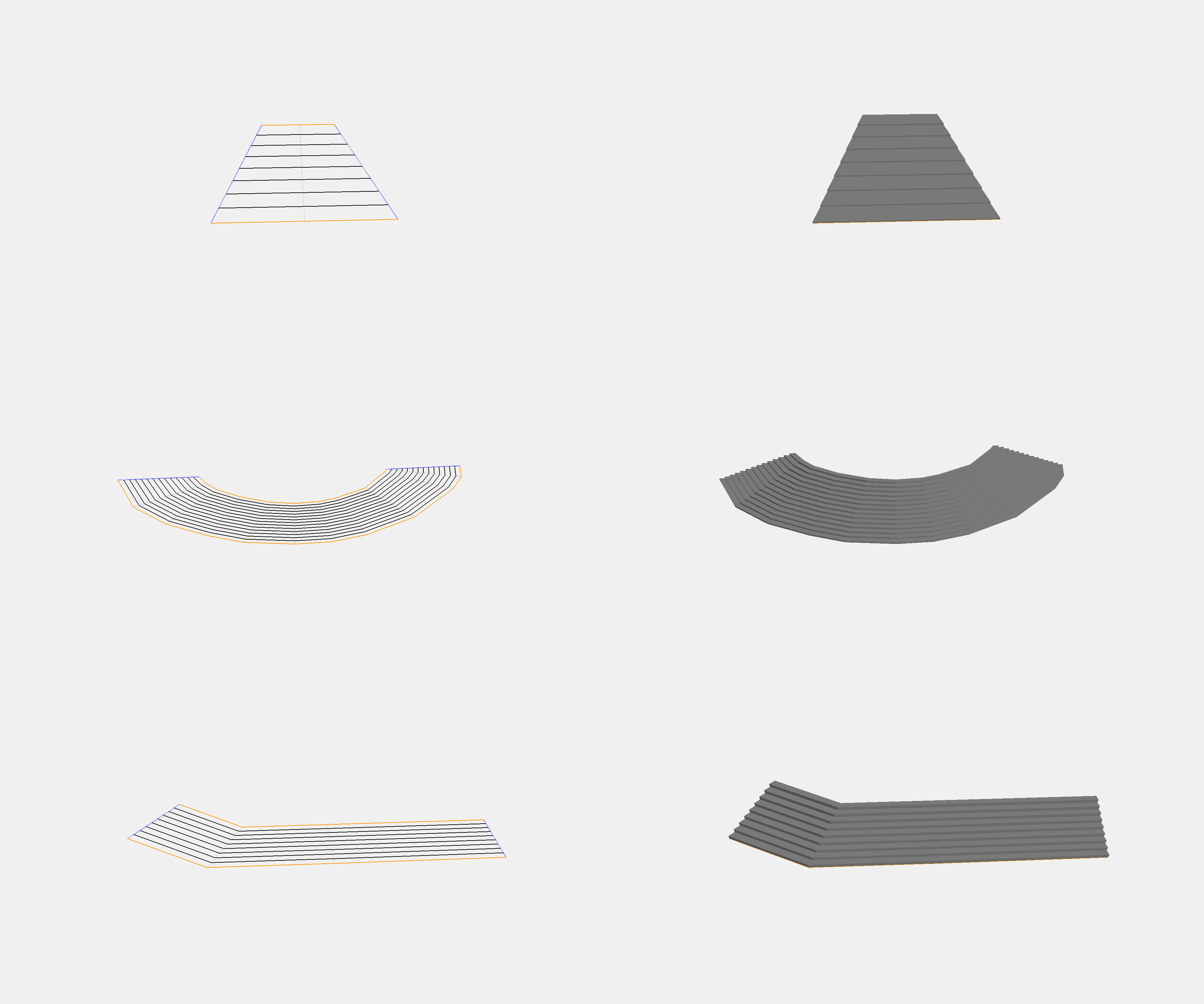
On Friday 03 May 2019, Tobias Knerr wrote:
>
> So I finally got around to building that prototype to test my idea.
> The code only needs a highway=step way and an area:highway polygon as
> input, and produces sensible results for common shapes of straight
> stairways. I'm pretty happy with the results:
>
> http://tobias-knerr.de/upload/Step%20Polygon%203D%20Examples.png
That illustration does not show the original data so it does not tell
very much.

What you are doing is probably non-problematic as long as the upper and
lower limit are at least roughly equidistant and the sides are strait.
But it will likely fail with most other shapes.  In particular for
stairs that are longer than wide and where the sides are more complex
in shape than the upper and lower limit this is likely to fail.

Like for example classic curved stairs:

https://www.alamy.com/stock-photo-one-of-the-curved-stone-staircases-at-picton-castle-near-haverfordwest-58935307.html

In general I would advise against defining the validity of a mapping
through some algorithm correctly interpreting it.  This is both awkward
in principle and it would have the effect of declaring a distiction
between 'legal' real world stairs and ones that might exist but are not
allowed to exist because the algorithm can't deal with them.

But in general testing the suitability of a data model by testing its
usability in practical interpretation is a good approach.

--
Christoph Hormann
http://www.imagico.de/

_______________________________________________
Tagging mailing list
Tagging@openstreetmap.org
https://lists.openstreetmap.org/listinfo/tagging