On 5 April 2010 14:10, John Robert Peterson <jrp....@gmail.com> wrote:
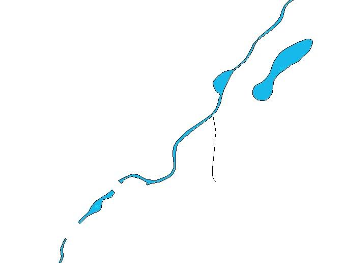
> Put differently -- can anyone think of any specific reason why we
> can't start tracing?
>
> Thanks,
> JR
>
>
JR, you might spend hours tracing Streetview images only to find someone
replaces it with 'VectorMap District' vector data in a couple of weeks. Why
trace the road when the vector data behind streetview will be released next
month?

I've had my first look through the various datasets this afternoon and I'm
really pleased. I agree with those who say we need to wait before tracing,
because we'll probably be using 'VectorMap District" which is released next
month

Each of the products released by OS contains data which may be of use to
OSM. We now need to look at the data within each product, decide what we
want to use, and how the data enters OSM.
The dominant source of data looks like being the data 'VectorMap District'
product, because its vector data and accurate. But there will be data in
Streetview not available in VectorMap District which will need tracing.

At this moment I do not support a straight import of any data from
'VectorMap District' because much of the data is already present in OSM.
I'd suggest something along the lines of converting the 'VectorMap Discrict'
data for each 2km grid square and making it available as a download that can
be used as a layer in JOSM. The corresponding area in OSM can be downloaded
into JOSM and the two 'brought together' if needed. Which I guess may mean
deleting a lot of existing OSM data because OS have mapped more accurately
in many situations.

I've had a look at the vector data provided for Milton Keynes and it's clear
we will need to discuss the individual layers available. Hopefully on the
wiki?
For example the 'water area' contains far more detail than I ever hoped to
see, and its a very important layer for many "map users". It inclusion
really stands out when you consider the missing fence lines and 'Rights of
Way'.
OS appear map the 'areas' of waterways over 1m wide, something OSM has not
been able to do with GPSr's and Yahoo imagery. (Waterways under 1m are shown
as lines by OS)

Looking at the waterways layer (and woodland layer) provides examples of why
we couldn't directly import it. Whenever there is a bridge over the waterway
the water way stops existing. Similarly the existence of a path causes
woodland not to exist over the path, so instead of one large woodland, it's
broken up into several small woodlands. (Maybe this is one of the issues OS
will address before the release of 'VectorMap District' next month?)

For example I used the example vector data for Milton Keynes to look at the
water layer. Below the first link show you can see example of the very
accurate vector data within 'VectorMap District'.
Its a stream running through Milton Keynes and less than two metres wide.
But the layer is broken up because the stream is not considered to exist
under bridges! The bridges/paths can be seen in the second link to "Where's
the path"
http://i227.photobucket.com/albums/dd132/jamicu/grassvectorofwaterinMiltonKeynes.jpg
http://snipurl.com/v9xsq

Cheers,
Jason Cunningham
_______________________________________________
Talk-GB mailing list
Talk-GB@openstreetmap.org
http://lists.openstreetmap.org/listinfo/talk-gb