Funnily enough I've been working on something similar now for a while.
It's not perfect and needs a bit more work, but I've uploaded a couple
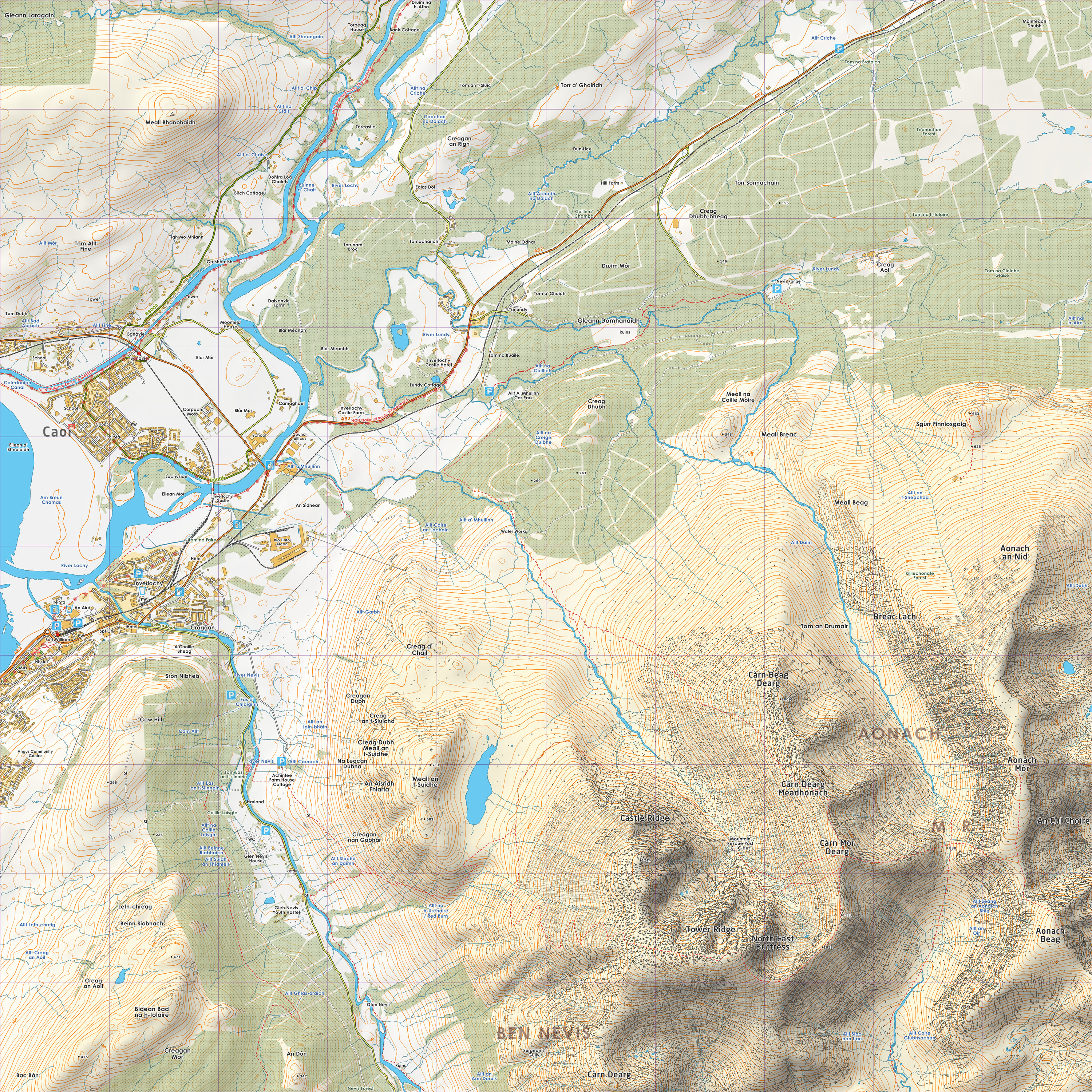
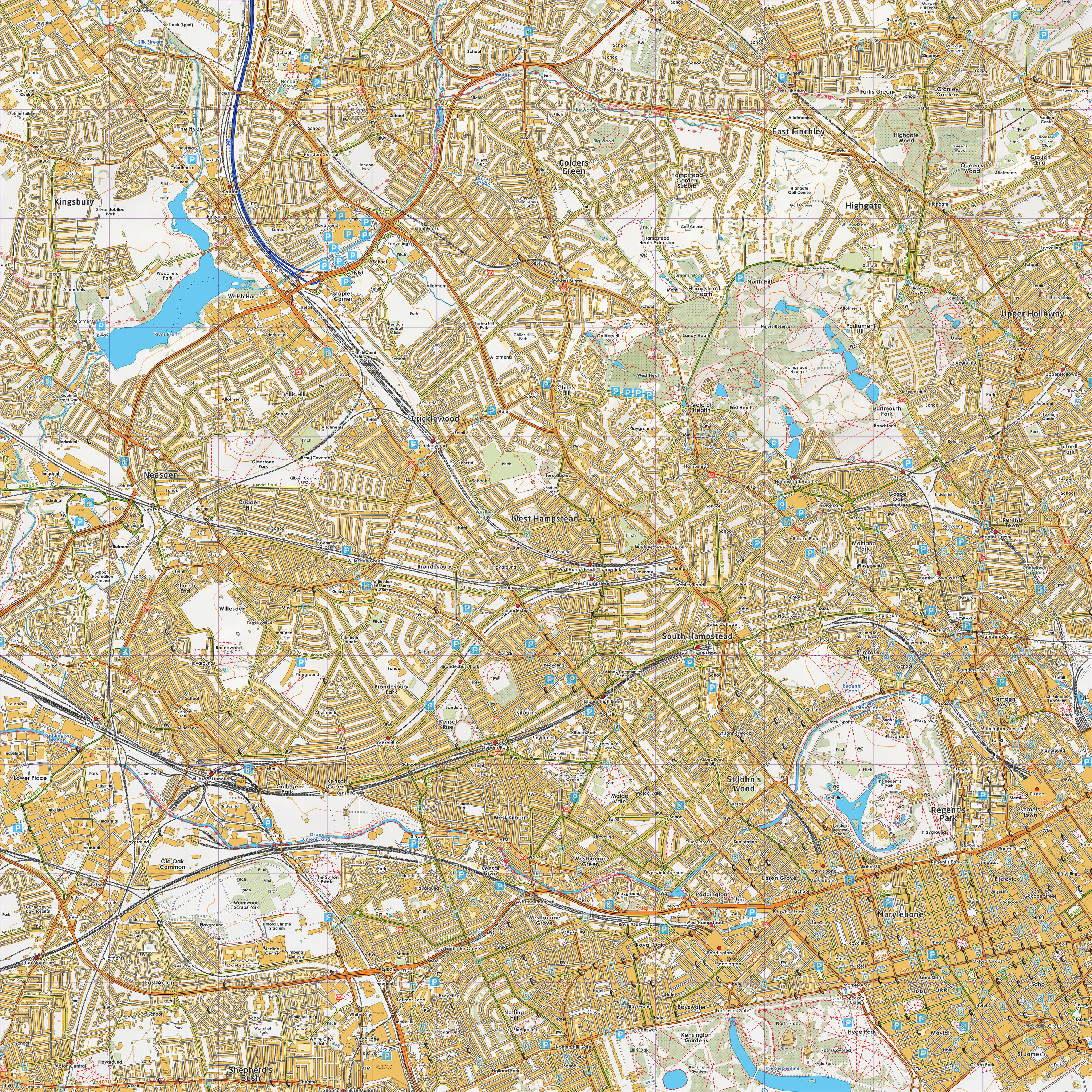
of tiles (one London, the other Ben Nevis).
http://www.grough.co.uk/lib/documents/tmp/lss/nn17.jpg
http://www.grough.co.uk/lib/documents/tmp/lss/tq28.jpg
That's been put together using a mixture of OS StreetView (buildings),
OS VectorMap District (roads, forests, water, crags), OS Landform
Panorama (contours, relief), OS BoundaryLine (civil parish names), OS
Strategi (national park boundaries, mountain range names) and
OpenStreetMap (point names, footpaths, parks, schools etc).
So if there's anything I can help with let me know.

Luke

Luke Smith | Technical Director
-
grough | the inside view of the outdoor world | news, features & community
tel 07817 961718 | email luke.sm...@grough.co.uk
<mailto:%20luke.sm...@grough.co.uk> | web www.grough.co.uk
<mailto:%20www.grough.co.uk>
"grough Limited" is registered in England and Wales. Registered number
06881144. Registered office 2 Spring Wells, Oakworth, Keighley, BD22
0QZ. This e-mail is for the intended recipient only and may contain
confidential information, if you believe you have been sent this message
in error please contact us.
On 12/03/2011 12:23, Nick Whitelegg wrote:
Hi,
I've managed to produce a slippy VectorMap District map with LandForm
Panorama contours overlay at
http://www.free-map.org.uk/expts/vmdlfp200/

Only covers a 20km x 100km section of southern England at the moment.

Next stage will be to overlay OSM rights of way on the map.

Will write up a wiki page on the method used once it's complete.

Nick


_______________________________________________
Talk-GB mailing list
Talk-GB@openstreetmap.org
http://lists.openstreetmap.org/listinfo/talk-gb
_______________________________________________
Talk-GB mailing list
Talk-GB@openstreetmap.org
http://lists.openstreetmap.org/listinfo/talk-gb