Hi,
One thing omitted in previous posts was the impetuous to map townlands in the
1840s - taxation via rates.
Some of the results of this was the creation of urban district councils (which
became town councils in 2001 and were abolished in 2014) and rural district
councils (long abolished). These were made up of District Electoral Divisions
(later renamed Electoral Divisions) which tried to balance area and population
(I'm sure some suitably-corrupt formula was used). Electoral Divisions are the
primary basis for the making of constituencies for electoral purposes.
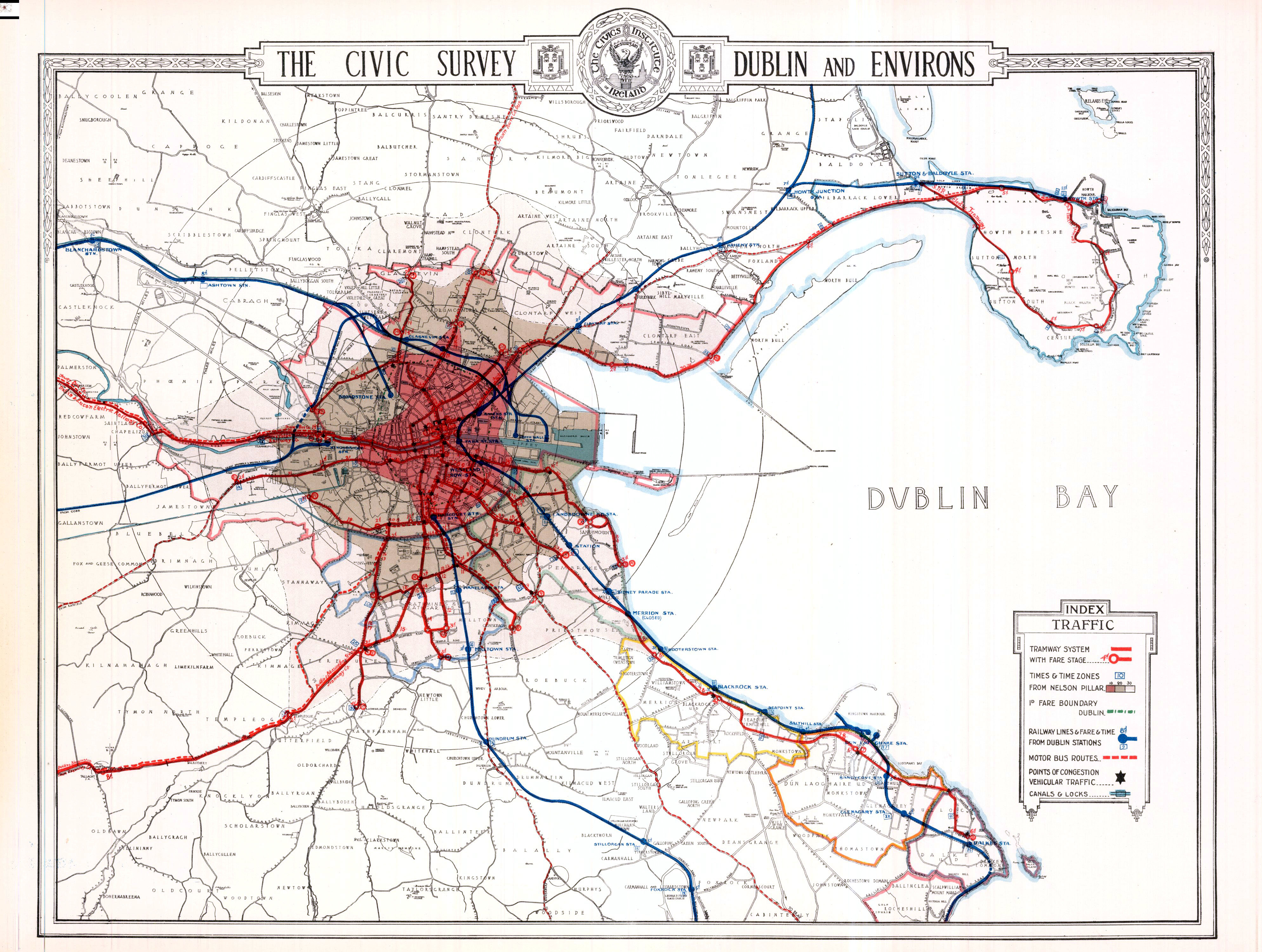
In County Dublin a result of the district councils was the creation of a string
of moneyed townships from Ballsbridge to Killiney
https://upload.wikimedia.org/wikipedia/commons/a/ad/Dublin_1922-23_Map_Suburbs_MatureTrams_wFaresTimes_Trains_EarlyBus_Canals_pubv2.jpg
and an increase of commuting, facilitated by the railways. As the townships
had mostly well-off people, they could keep rates low, as they didn't need to
support large numbers of poor people, who mostly lived in the city proper.
Pembroke Township (modern Dublin 4)
https://en.wikipedia.org/wiki/Pembroke_Township was the most prominent - You
may have heard of Richard de Clare, 2nd Earl of Pembroke commonly known as
"Strongbow", who led https://en.wikipedia.org/wiki/Norman_invasion_of_Ireland
That's how interconnected history is. :)
Colm
---------------------------------------------------------------------------------------------------------------
Never doubt that a small group of thoughtful, committed citizens can change the
world. Indeed, it is the only thing that ever has. Margaret Mead

_______________________________________________
Talk-ie mailing list
Talk-ie@openstreetmap.org
https://lists.openstreetmap.org/listinfo/talk-ie