Hi,

Request for Comments (RFC) for importing Palawan Road Data.
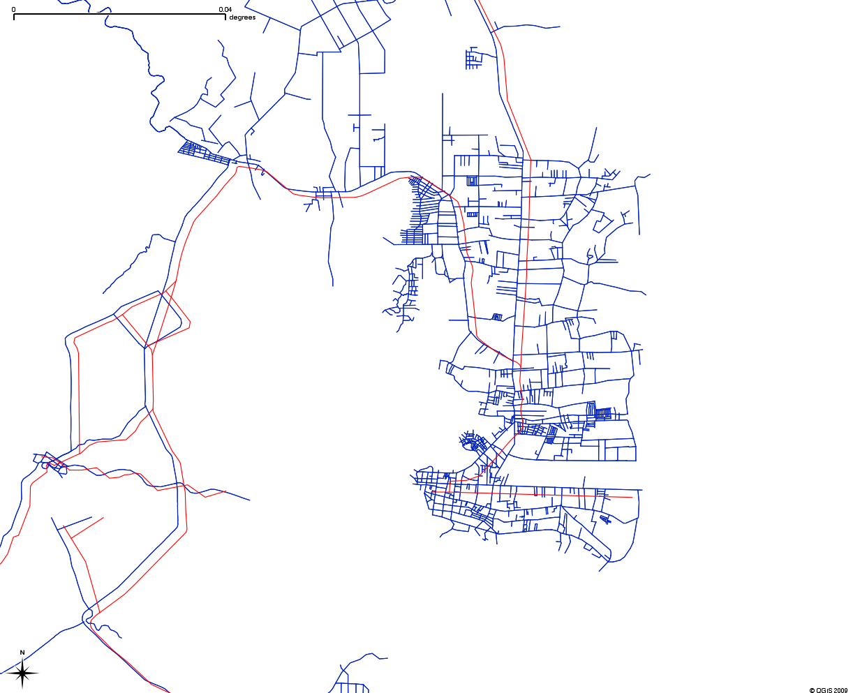
An engineering/surveying company gave me data for the roads of
Palawan.  The company allowed us to add this data to Openstreetmap.
I am fairly certain it didn't come from copyrighted sources, since
they surveyed it themselves.

See coverage here:
whole Palawan
http://farm4.static.flickr.com/3401/3597237046_913bd6f8cb_o.png

subset for details (red is OSM road, blue is the data):
http://farm3.static.flickr.com/2293/3597238322_c0b6e5c188_o.png

The problem is:
1.  No attribute information (road name and type).  Just a lot
topologically and positionally accurate lines.
2.  The data seems shifted westward by a few meters (probably a datum issue,
should be easy to manually adjust before upload).

We had imported this kind of data before (Laguna roads).  AFAIK,
laguna editors like ianlopez had to manually edit a lot to make it
what it is now.

Any advice? Some options I can think of are:

1.  Don't add it, we might have a lot of data but not very useful (no
road name, type).  Might be more difficult to maintain (something like
Tiger data before).
2.  Convert it to GPX and allow Palawan editors (meron ba?) to use it
as reference for tracing.
3.  Import with the following tags:

highway=road
source=name of company
FIXME=fix for names and highway type.


--
cheers,
maning
------------------------------------------------------
"Freedom is still the most radical idea of all" -N.Branden
wiki: http://esambale.wikispaces.com/
blog: http://epsg4253.wordpress.com/
------------------------------------------------------

_______________________________________________
talk-ph mailing list
talk-ph@openstreetmap.org
http://lists.openstreetmap.org/listinfo/talk-ph