I did a quick ogr2osm conversion on the street data from here:

        ftp://ftp.oregonmetro.gov/odi/Streets.zip
I stuck it up here:
http://daveh.dev.openstreetmap.org/portland/
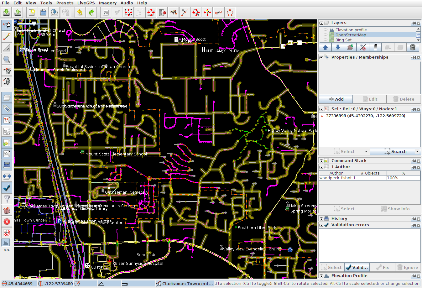
I loaded it in (JOSM takes ~1.2GB of RAM doing this), along with some
downloaded OSM data. Then I set the "inactive" color to a nice, bright
pink, and selected the downloaded OSM data layer. The streets that
aren't in OSM already stand out pretty clearly:
http://daveh.dev.openstreetmap.org/portland/josm-ping.png
Wherever you see pink, there's potentially a problem. It might be a
misaligned or missing OSM road. This doesn't guarantee the names are
right or anything, but it's at least nice to get a handle on how
complete the OSM data is and how well it coincides with Metro's.
I'm fairly impressed with how OSM stacks up. It's also neat how much of
the "missing" stuff has actually been traced from imagery, but just
needs names stuck on it.
If this looks like something that might be usable for doing a manual
import of new streets, we can probably work on a nicer JOSM style file
to make the process even easier visually.
-- Dave
_______________________________________________
Talk-us mailing list
Talk-us@openstreetmap.org
http://lists.openstreetmap.org/listinfo/talk-us