sent from a phone
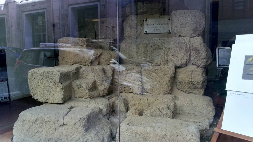
> On 27 Oct 2022, at 01:44, Zeke Farwell <[email protected]> wrote:
>
> I support mapping old rail beds as railway=razed where they are visible in
> forests, fields, and other open land.  These traces are often not visible to
> those with an untrained eye and that's certainly an issue.  However, I draw
> the line at sections going through buildings, highways, excavated areas, or
> under water where there really are no visible traces by any reasonable
> standard.


New buildings standing on top are often brought up as the point where predating
features at the same spot should be considered disappeared, but this is not an
universal criterion, indeed I very often see traces of former features in the
gardens, entrance areas and basements of buildings. The more massive a
structure was, the more likely you’ll probably find some remains.
Here’s an example of some former city walls visible in a shop window:
https://3.bp.blogspot.com/-OnUPS1SpI3g/WPYNxl4EFXI/AAAAAAAAJjg/nNTpu2-J4u4MYR1dDGPMhHP4zdd_n6IQQCLcB/s1600/17990776_1335536786482546_2806219406469521007_n.jpg
 (this is from the “first” city wall (severian) of which not so much is still
visible today)

An example for more recent remains: some time ago you could still see in Berlin
(before they actually reconstructed the current fake version) a few street
lamps attached  to buildings that were formerly
 used for illuminating the Wall, although the wall itself had been “completely”
demolished. Not recognizable for everyone, but clearly visible traces if you
knew to read them.

Cheers Martin
_______________________________________________
talk mailing list
[email protected]
https://lists.openstreetmap.org/listinfo/talk