Jonathon Suggs wrote:
Andrew Turner wrote:
Caching googlemaps tiles, and not through their client, is a violation
of their Terms of Service. Same for all the other providers.
<snip>
Here's an interesting question. What if you constantly logged your
position (while driving). Then when you got back home, you could upload
all of your data back to your desktop. Would it be legal to have a
script analyze that data, and make "suggestions" from public sources (ie
google maps, mapquest, etc) as to what roads you traveled. Once you
verified that information it could automatically upload back into
OpenStreetMaps (OSM)? Basically just reducing some of the time/effort
required to upload information into OSM.
Not really, no.
Street names are in some cases faked, to catch this very thing.

At the moment, the upload process for OSM works like either:
Upload your GPX file to the server.
This then appears as a background trace in most map editors - lots of
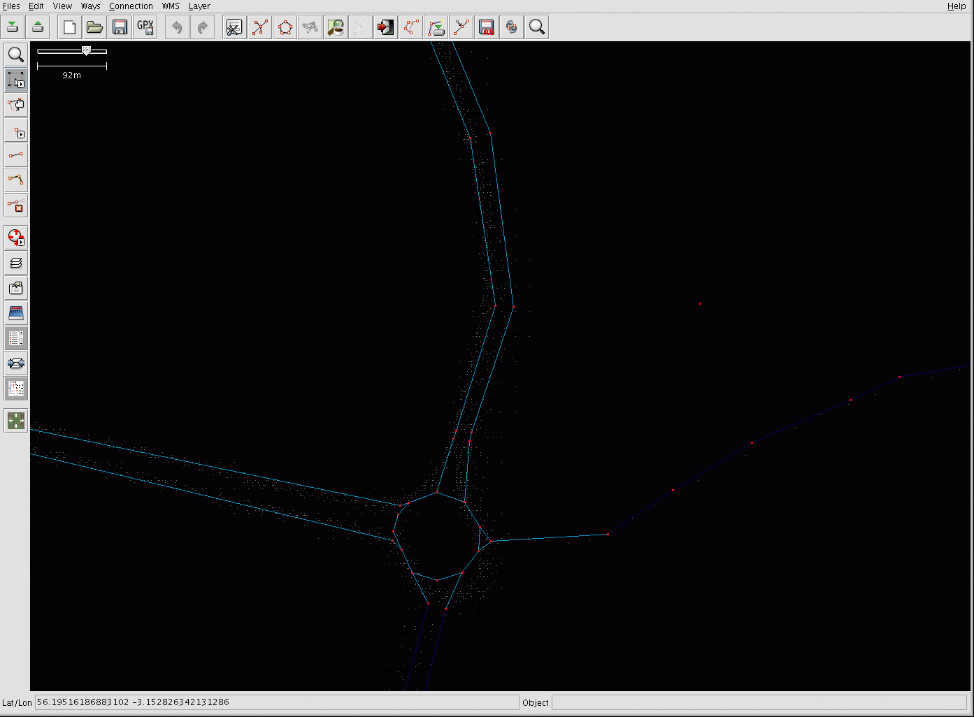
little dots http://www.mauve.plus.com/josm.gif .
This is of use, for those that then go and put in the ways (highway,
waterway, cycleway, outline of a wood), if they have local knowledge of
the road in question. (they are commonly the same person).
In the image shown, the GPS traces are shown as little white dots - the
road to the right is one journey. The other roads each have several
journeys, which help define the accurate course of the road.
For a simple long-distance road - say the vertical one on the
right-hand-side, it may have several tags, for example
oneway=true
highway=trunk
ref=A92
As it's a trunk road, the A92, and each way is one way only - you can't
do a u-turn as there is a central reservation.
And yes, this means that for a good quality map, someone has to decide
where on the GPS trace the road goes, using local knowledge. If the GPS
trace is simply a road, a cross-country run, or a train, and where
Bruntun Place turns into Bruntun Street, by looking at signs and either
remembering, or photographing them and then consulting the photos which
are automatically glued to the map by timestamp.
However.
Even 'dumb' users, for example, ones that are not going to be willing to
enter streetnames, but might be persuaded to push 'car' on the
screensaver when they are in their car, are of use.
You can extrapolate some probable data out of multiple tracks,
especially accurate road position, number of lanes, junctions (where
people often stop).
Doing so out of one track is comparatively really hard.

_______________________________________________
OpenMoko community mailing list
community@lists.openmoko.org
http://lists.openmoko.org/mailman/listinfo/community