On Mon, Apr 16, 2012 at 1:03 PM, Frank Cox <thea...@melvilletheatre.com> wrote:
[ ... ]
> It occurs to me that I may have been doing this wrong, and if so now would be
> the time to find out about it.
>
> The Coop grocery store, for example, is laid out as a building on a large lot,
> the unoccupied portion  of which is customer parking.  I outlined the store,
> marked that as the Coop, then outlined the parking lot and marked that as
> parking.   However, I'm wondering if I should have outlined the whole thing
> and
> marked that as the Coop, then made two smaller outlines within that for the
> building and the parking lot.  If so, should I also name the smaller outlines
> as Coop, or is naming the large outline around everything sufficient?
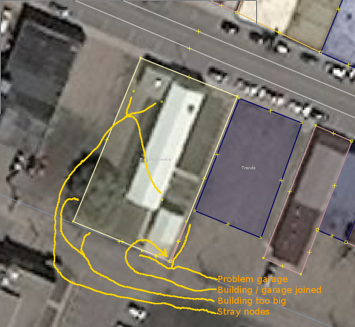
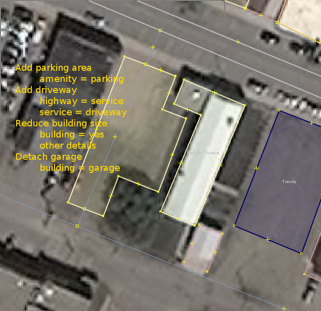
My preference is to draw two separate outlines.  One for parking, one
for the building.  Tag the building as
building = yes
shop = greengrocer
name = Coop

tag the parking area as
amenity = parking

For "extra marks" :-) I would add a driveway from the road to the
parking polygon and tag it:

highway = service
service = driveway

And I would be sure to connect the driveway at the road and the
parking polygon with a connecting node.

Let's look at the Melville Theatre, shall we?

http://rweait.dev.openstreetmap.org/Melville-theatre-before.png

I see a couple of problems here.
The garage is folded over on itself
There are stray nodes
The building appears too big
No parking is shown

I would map it as follows. You can do better, since you are there.  I
did not save my edits.  This is just an example.

http://rweait.dev.openstreetmap.org/Melville-theatre-after.png

Reduced the building size and added parking.  Does the building extend
further south?
Add driveway
Delete stray nodes
Detach building / garage

Enjoy.

_______________________________________________
Talk-ca mailing list
Talk-ca@openstreetmap.org
http://lists.openstreetmap.org/listinfo/talk-ca