Hi Hal, and thanks for that.

In my case at least there's no problem with making plots from live data as Lady
Heather will do that for me,
it's just the time taken to collect the data for each plot that could be an
issue.
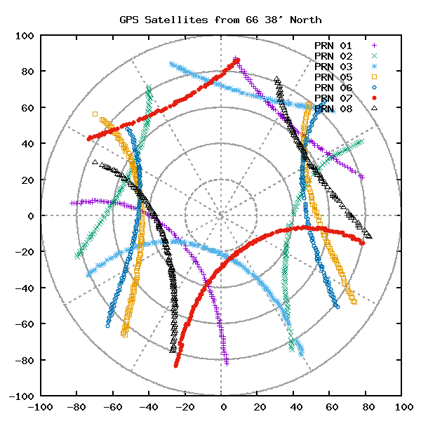
I'd just been wondering aloud whether any of the online simulations for
instantaneous plots against location
could be persuaded to quickly build a longer term prediction, but then it
occured to me that as I was looking to break
the rules anyway the chances of that might be quite small:-)

Nigel, GM8PZR


It's not hard to make your own plots.  This is from 66 38' north.
  http://users.megapathdsl.net/~hmurray/time-nuts/Arctic/Polar-A.png

If anybody wants to play, I'll put the code on the web.

There are several steps.  First is to collect the data.  I have a python
script that grabs everything from a NMEA device and logs each line with a
time stamp.  The GPS orbit period is 12 hours so you need 12 hours of data to
see everything.  But there are 30 satellites, so a few hours will show the
hole.

The next step is to extract the data into a useful format.  That's another
python script.  Then, just feed that to gunplot.
_______________________________________________
time-nuts mailing list -- [email protected]
To unsubscribe, go to https://www.febo.com/cgi-bin/mailman/listinfo/time-nuts
and follow the instructions there.