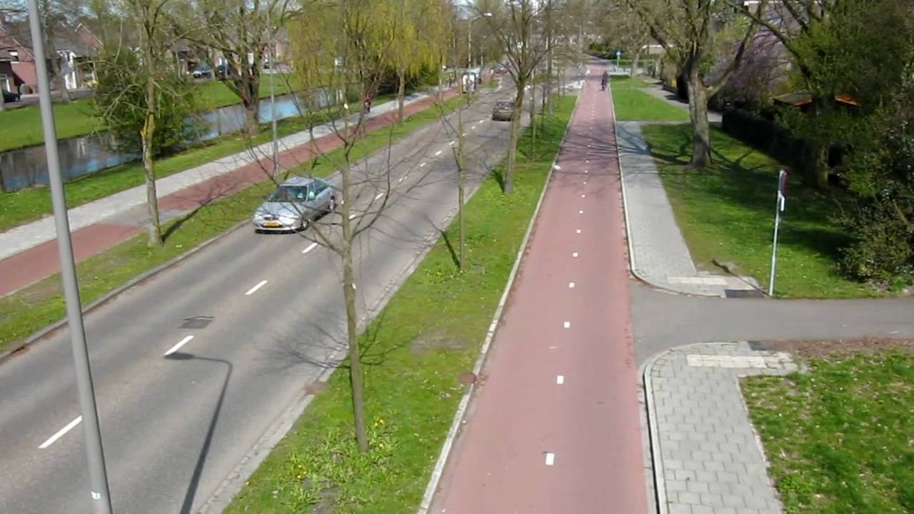
Just to add by the way, in a country like netherlands "cycleways" are paved
paths dedicated to cycles. You can't walk on there because there are also
sidewalks to walk on. E.g.:
https://i.ytimg.com/vi/pAL4yr927e4/maxresdefault.jpg

--


10 Dec 2020, 14:08 by tonyo...@gmail.com:

>
> Are there any public cycleways from which pedestrians are        actually
> banned?
>
>
> Unfortunately yes - > https://www.openstreetmap.org/way/827379295
>
>
> Quite clear signage - Mapillary - >
> https://www.mapillary.com/app/?lat=53.66933432657343&lng=-2.6290113968031967&z=17&pKey=_ir_HmYAIa4H0rnj1JrO8A&focus=photo>
>
>
> When I walk there I take my chances on      the illegal walking along a
> cycleway rather than the 50 mph dual      carriageway where it is legal to
> walk.
>
>
> Tony Shield - TonyS999
>
> .
>
> On 10/12/2020 12:47, Martin Wynne      wrote:
>
>>> My reasons for changing it, is that it is        shared use path with a
>>> greater number of people of foot than        bicycle (about 5:2)
>>>
>>
>> Many public bridleways have many more walkers and cyclists using      it
>> than actual horse-riders. But are still mapped as bridleways.
>>
>>  Map it as a cycleway, unless it is a public bridleway, in which      case
>> map it as bridleway. You are mapping the status, not the      actual usage.
>>
>>  My feeling is that a highway should be mapped at the highest level      of
>> permitted usage. The assumption is that pedestrians can go      almost
>> anywhere anyway. Motorways excepted.
>>
>>  Are there any public cycleways from which pedestrians are actually
>> banned?
>>
>>  cheers,
>>
>>  Martin.
>>
>>  _______________________________________________
>>  Talk-GB mailing list
>>  >> Talk-GB@openstreetmap.org>>
>>  >> https://lists.openstreetmap.org/listinfo/talk-gb>>
>>
_______________________________________________
Talk-GB mailing list
Talk-GB@openstreetmap.org
https://lists.openstreetmap.org/listinfo/talk-gb