On Tue, Jun 11, 2013 at 3:45 PM, Darrell Fuhriman <darr...@garnix.org>wrote:
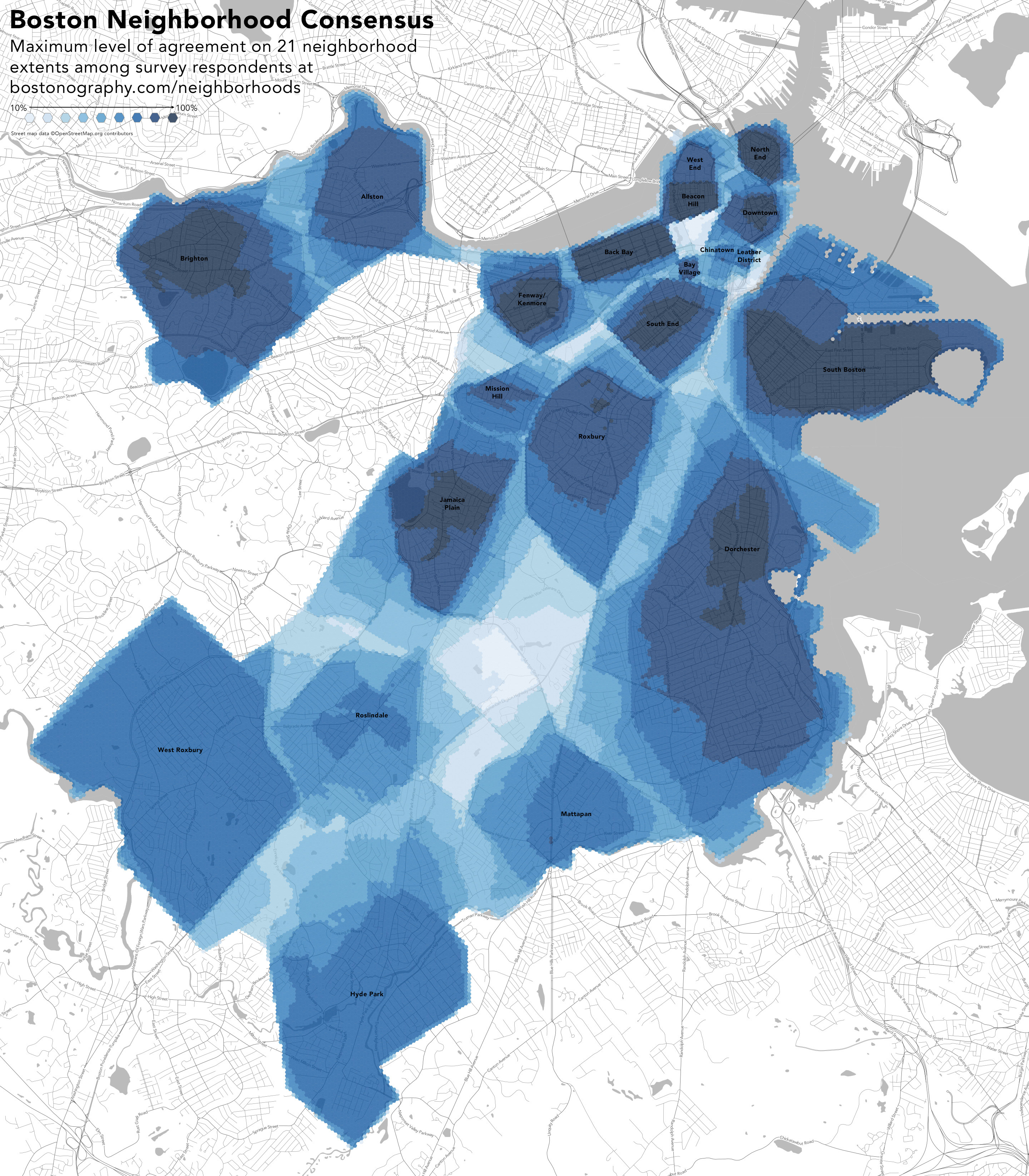
> You'd end up with this:
>
> http://bostonography.com/images/misc/neighborhoods_labeled.jpg
>
> Discussed here:
>
> http://bostonography.com/2012/wanted-your-map-of-boston-neighborhoods/
>

True. I suppose part of it is wanting to be associated with a more
desirable neighborhood.

One of the advantages of just using a neighborhood node is not having to
have fixed boundaries. If we got survey results back we could then average
the results to find a center point for the node. Fuzzy logic anyone?

--
Clifford

OpenStreetMap: Maps with a human touch
_______________________________________________
Talk-us mailing list
Talk-us@openstreetmap.org
http://lists.openstreetmap.org/listinfo/talk-us